
Point 13020/Pico Aislado
Statistics
- Date - 06/05-06/2026
- Elevation - 13,020'/13,611'
- Route - West Ridge/West Ridge
- Miles - 11.4
- Elevation Gain - 6,003'
- ACME Mapper - Link
- CalTopo - Link
- Partners - Not Applicable
Description
This was a backpack and scramble to my final Bi-Centennial Peak in the Sangre de Cristo Mountains with the exception of two that are on private property that you have to pay to hike on the southern end of the range. Last summer I hiked over Music Pass and climbed Tijeras Peak with plans to also scramble to Pico Aislado from Upper Sand Creek Lake and Milwaukee Peak. Unfortunately, I had just returned from an overseas trip. I was super tired and my body had not adjusted to being stateside, so my daughter and I just enjoyed the morning at the lake and returned to the trailhead after one night of backpacking.
Since I was working in the San Luis Valley and had already approached the area from the east, I decided to backpack up Cottonwood Creek from the west and attempt the west ridge of Pico Aislado. Cottonwood Creek is often used an an alternative approach to Colorado 14ers Crestone Peak and Crestone Needle. I left the private trailhead at 1:15 pm and reached the Cottonwood Lake/Crestone Peaks trail junction at 4:45 pm after 3.5 hours of backpacking. The backpack in was approximately 4 miles and 2,500' in elevation gain. The trail is strong and wide for the first 1.5 miles, strong and narrow for the next 1.5 miles, and then the last section had a fair amount of cairns and rock slab hiking to the trail junction. I had initially considered trying to reach an unnamed lake at 11,800' west of the peak, but ultimately decided to camp at the junction at 11,200' and was glad I did. The trail got significantly harder to follow from this point and the hike to the lake ended up being fairly steep, which would have been more challenging with a full pack.
I spent the evening setting up camp, resting, eating, and hydrating. Despite going to bed early, I didn't sleep much throughout the night. I was warm, the weather was good, and I had a nice camp spot, I just simply couldn't stay asleep very long. Nevertheless, I was up early and hiking by 5:00 am. I lost the trail a couple of times moving farther east up Cottonwood Creek but quickly found the gully used to access the unnamed lake to the south. The gully was steeper with no defined trail, but it didn't take me long to reach a nice bench above the lake where I removed a layer.
From above the lake, I could see my next objective which was essentially a shallow saddle on the summit ridge to both Point 13020 and Pico Aislado. The gully to reach the ridge was loose and rotten and the least enjoyable section of the day. It ended up being even more of a nuisance on the descent. I ended up hugging the left side of the gully and often moved into class 3 terrain since it was significantly more stable. I reached the ridge and saddle between Point 13020 and Point 12989 at 7:00 am after two hours of bushwhacking and scrambling.
At this point, I got my first good look at the west ridge of Pico Aislado and would be lying if I said it didn't look a little intimidating. It looked very steep and technical; however, the research I did indicated it was class 2 so I pressed on. I quickly made it to the summit of Point 13020, a Colorado ranked summit, and had a clear view of the ridge to Pico Aislado. The ridge line was solid and enjoyable hiking. The rest of the route to my final objective still looked challenging, but it laid back as I got closer. I dropped 350' to the saddle between Point 13020 and Pico Aislado and began a longer ascent on continued tight rock. I stayed directly on the west ridge proper all the way to the summit, which ended up being a fair amount of class 3 and a few sections of class 4.
I reached the summit of Pico Aislado at 9:00 am after four hours of hiking and scrambling. The views and perspective were very impressive as I looked both north and south to many peaks I had been to the summit of including Crestone Peak, Crestone Needle, Crestolita, Broken Hand Peak, Humboldt Peak, and Colony Baldy. Others hidden behind the Crestones were Challenger, Columbia, Kit Carson, Mount Adams, and Obstruction Peak.
I was only on the summit for 10 minutes before reversing my route and working my way back to camp. Once I reached the top of the west ridge proper, I noticed a shallow gully to the south of the ridge that looked like it would go. I decided to try and descend this gully and avoid downclimbing the class 3/4 ridge. Surprisingly, it went very quickly and easily and I was soon back at the saddle at 12,650' between Point 13020 and Pico Aislado. After a bit more reading on SummitPost when I returned, the gully is the standard west face route from the west and the ridge is listed as a spicy alternative. Nevertheless, I enjoyed the ridge and appreciated the quick descent of the west face gully.
From the saddle, I had to gain another 350' back to Point 13020 and then it was pretty much all down hill back to Cottonwood Creek Trailhead. After going up and over Point 13020, I found myself looking back down the rotten gully I had ascended a couple hours earlier and was not too excited. I went fairly slow and simply worked my way down trying not to kick too many rocks loose. By the time I got back to the bench above the unnamed lake at 11,800', I noticed three fisherman enjoying the morning. I quickly scrambled back down to Cottonwood Creek and my camp, which I reached at 12:00 pm for a 7 hour camp-to-camp morning.
My blood sugars crashed to below 50 at this point so I took my time resting and packing up camp for an hour as I recovered and got my glucose back to an acceptable level. I was pretty tired and moved at a leisurely pace on the backpack out, but did reach the trailhead at 3:30 pm after another 2.5 hours of hiking out. I stopped quickly for a couple of cold energy drinks for the drive home, which I reached at 7:30 pm.
Photos
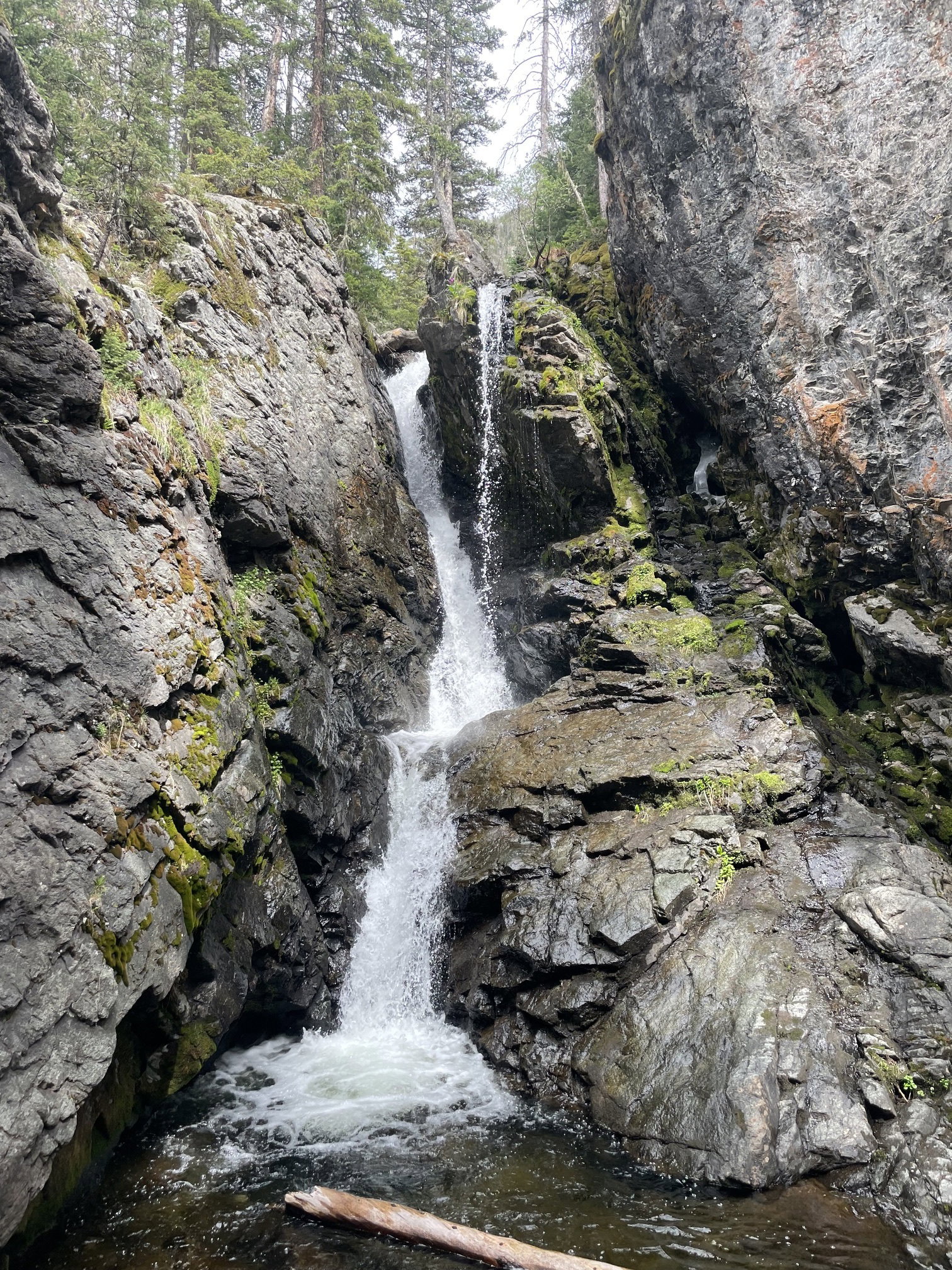
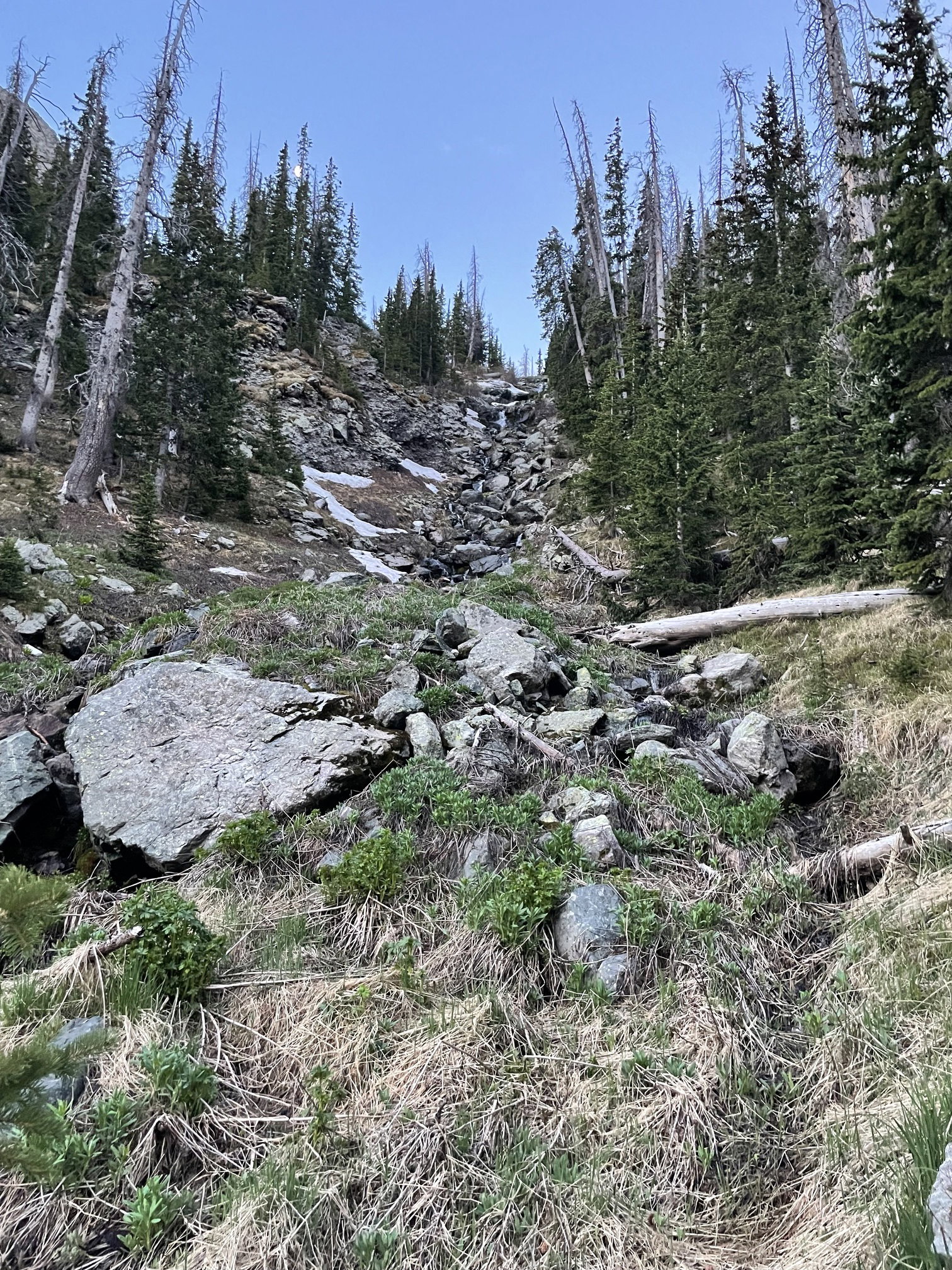
A waterfall on the hike in along Cottonwood Creek
A look back down Cottonwood Creek after backpacking for a few hours.
Pico Aislado and Point 13020 from near my camp spot.
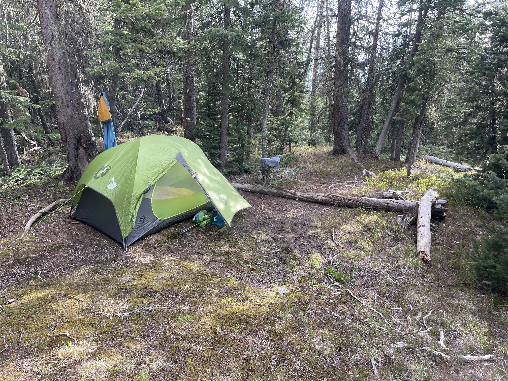
My home for the night.
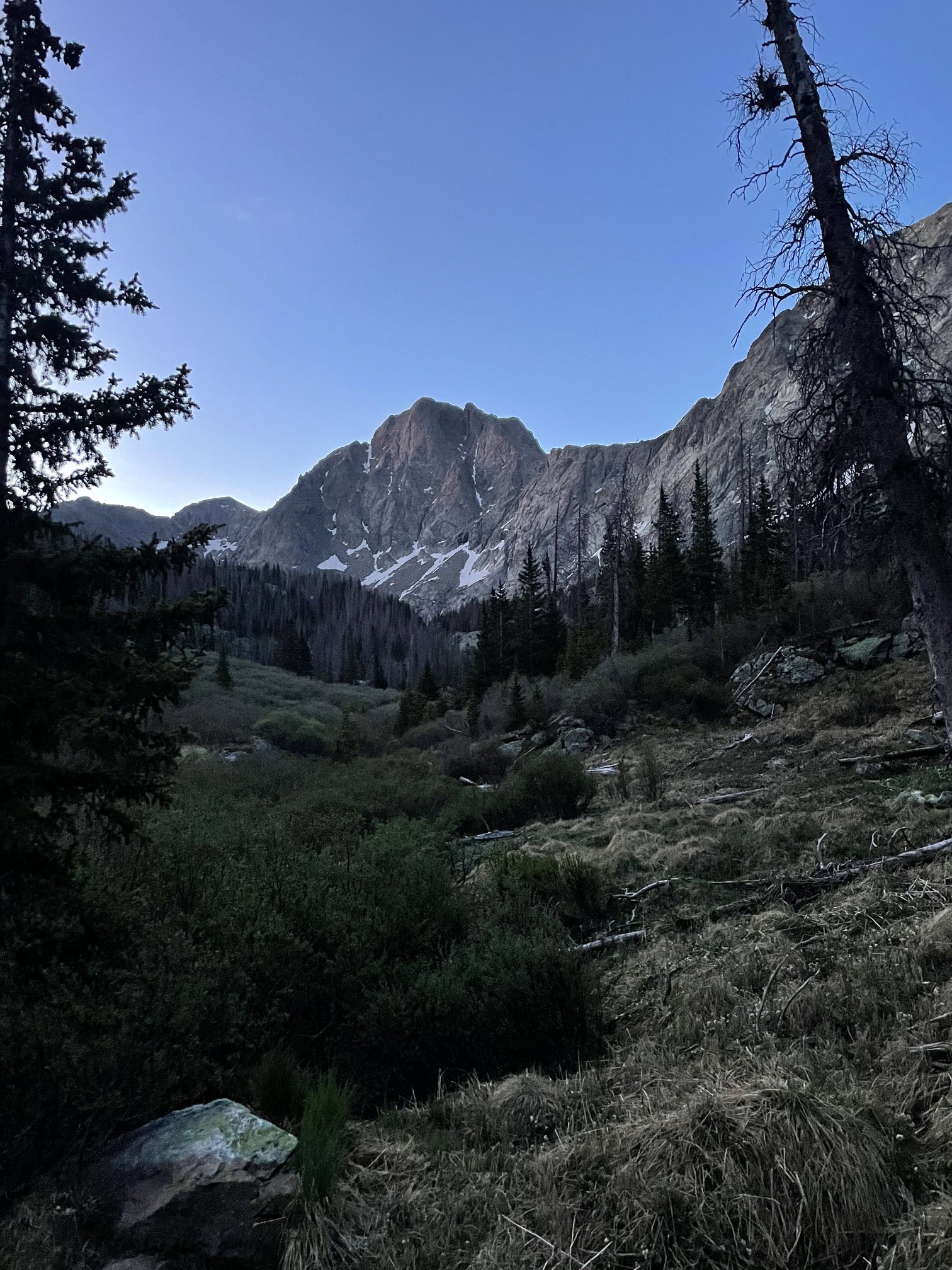
Pico Aislado from Cottonwood Creek.
The gully used to gain access to the unnamed lake at 11,800'.
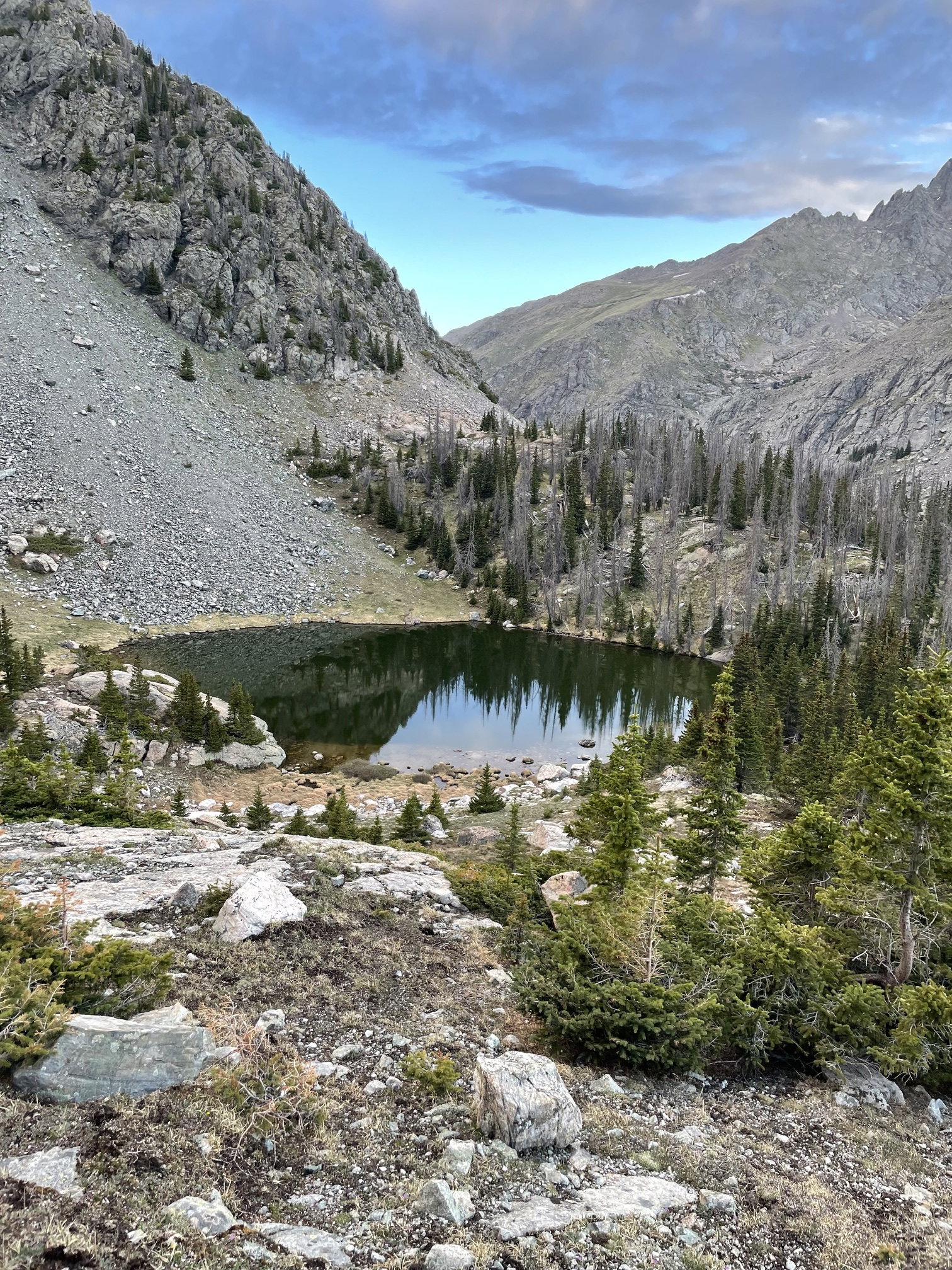
Unnamed Lake 11800 west of Point 13020 and Pico Aislado.
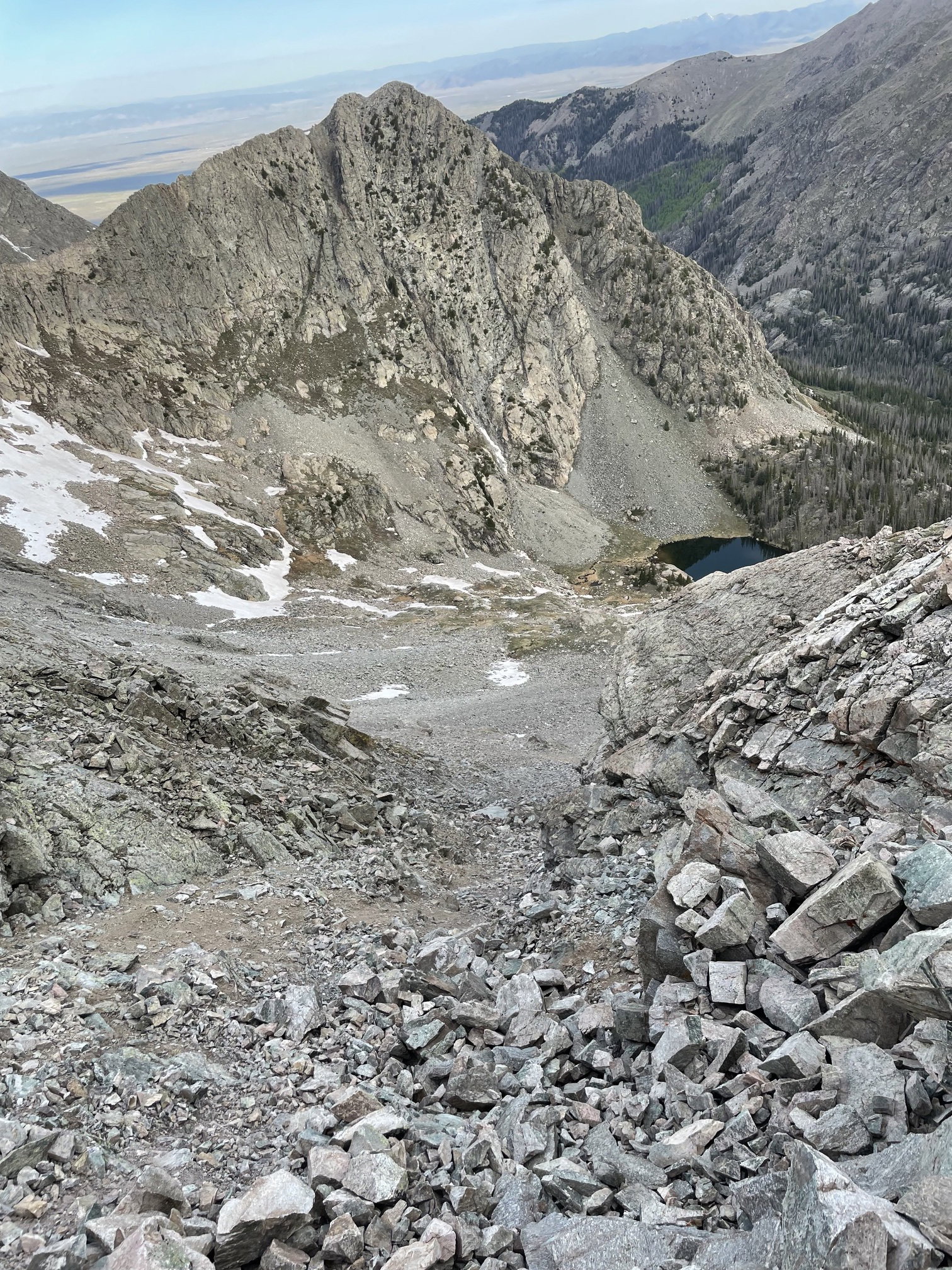
The nasty gully I climbed to reach the saddle between points 13020 and 12989 with Point 12751 and Unnamed Lake 11800 in the background.
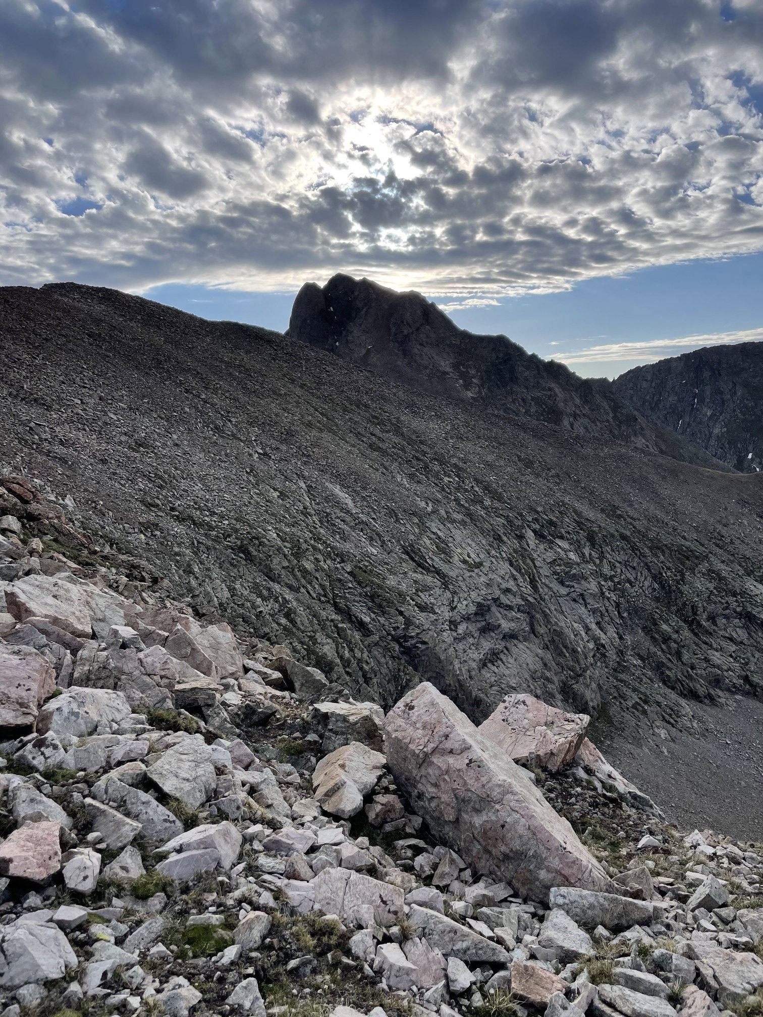
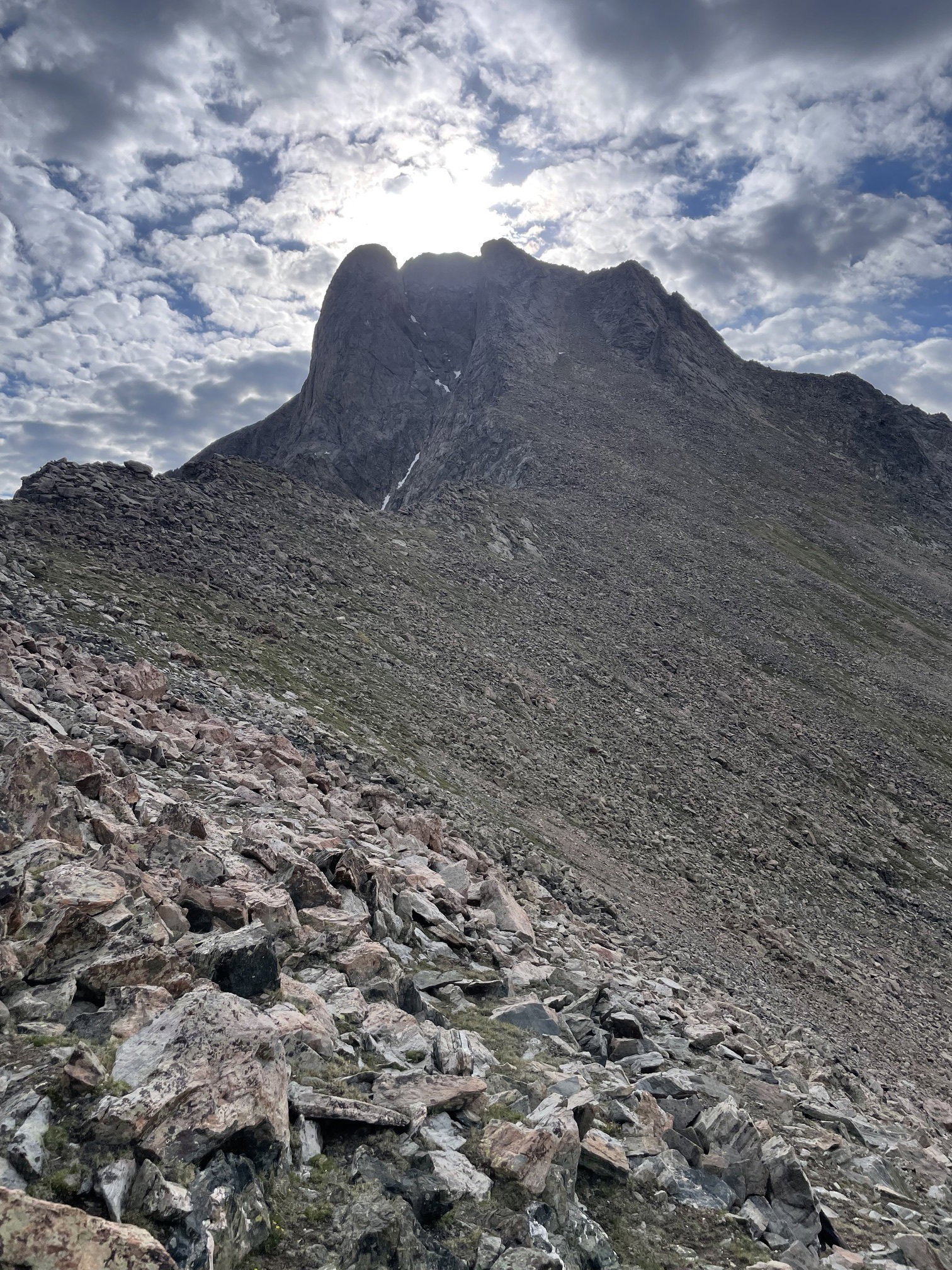
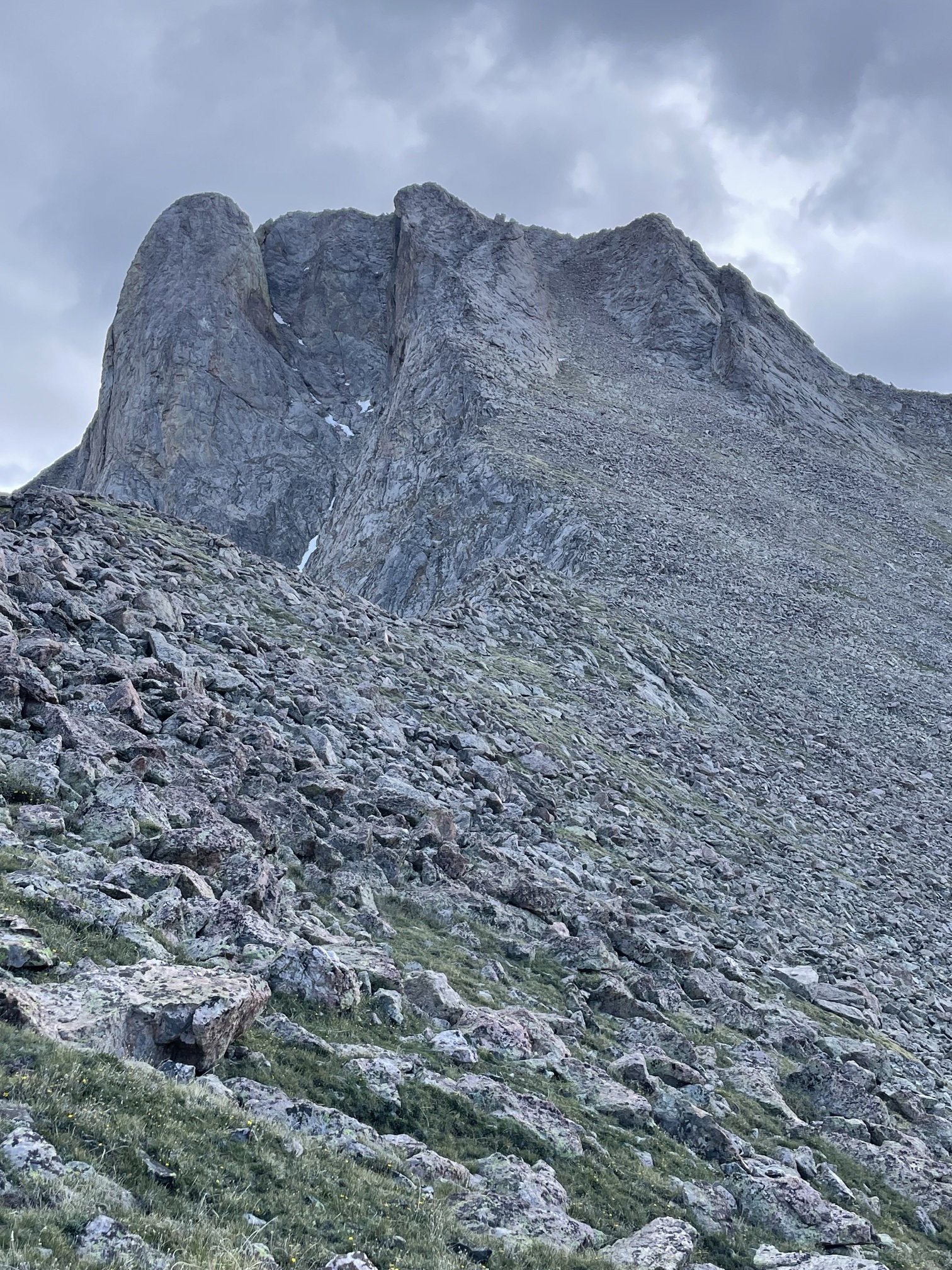
My first close up look at Pico Aislado.
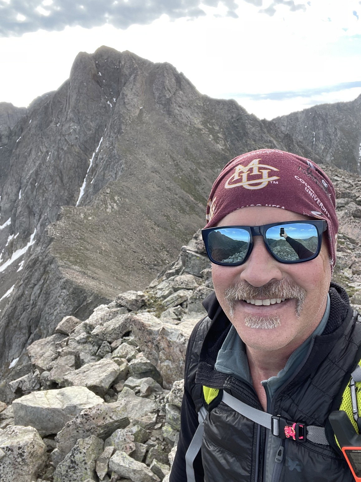
Summit Photo (Point 13020)
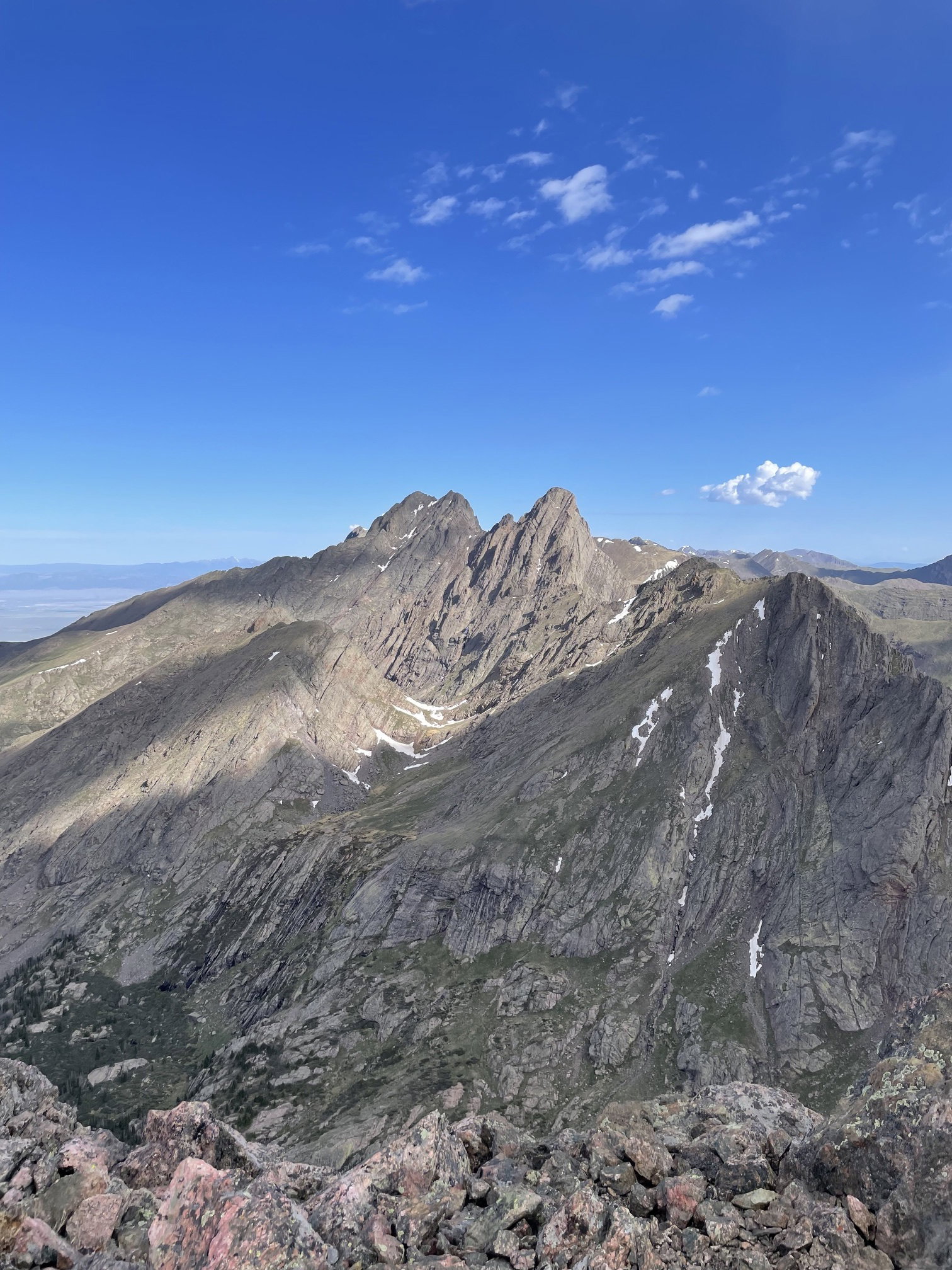
Pico Aislado from Point 13020.
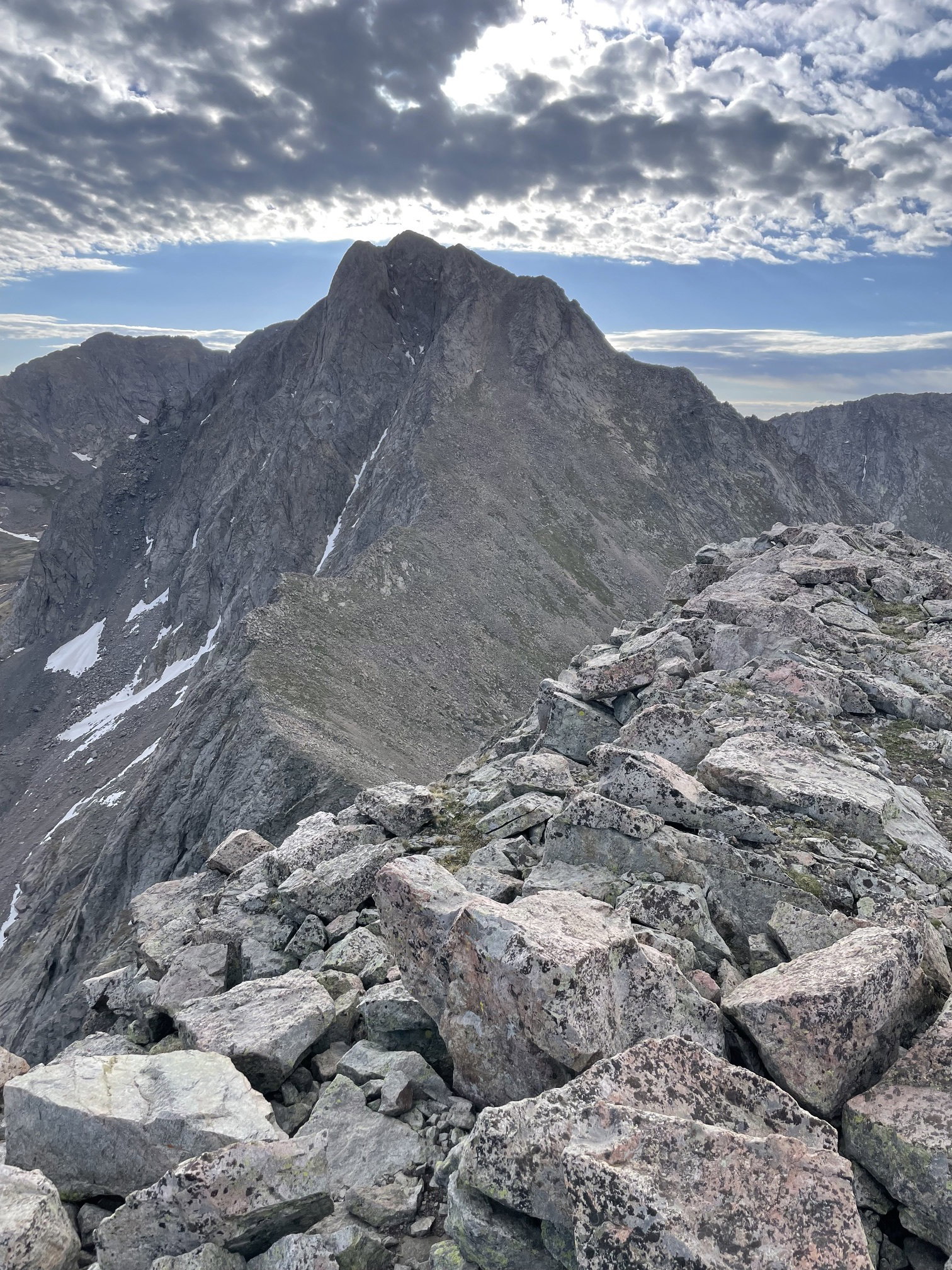
Looking back up at Point 13020 after descending to the saddle between it and Pico Aislado.
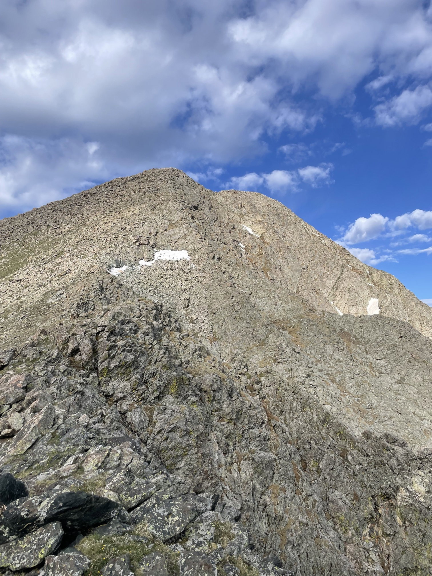
Looking up at Pico Aislado after descending to the saddle between it and Point 13020.
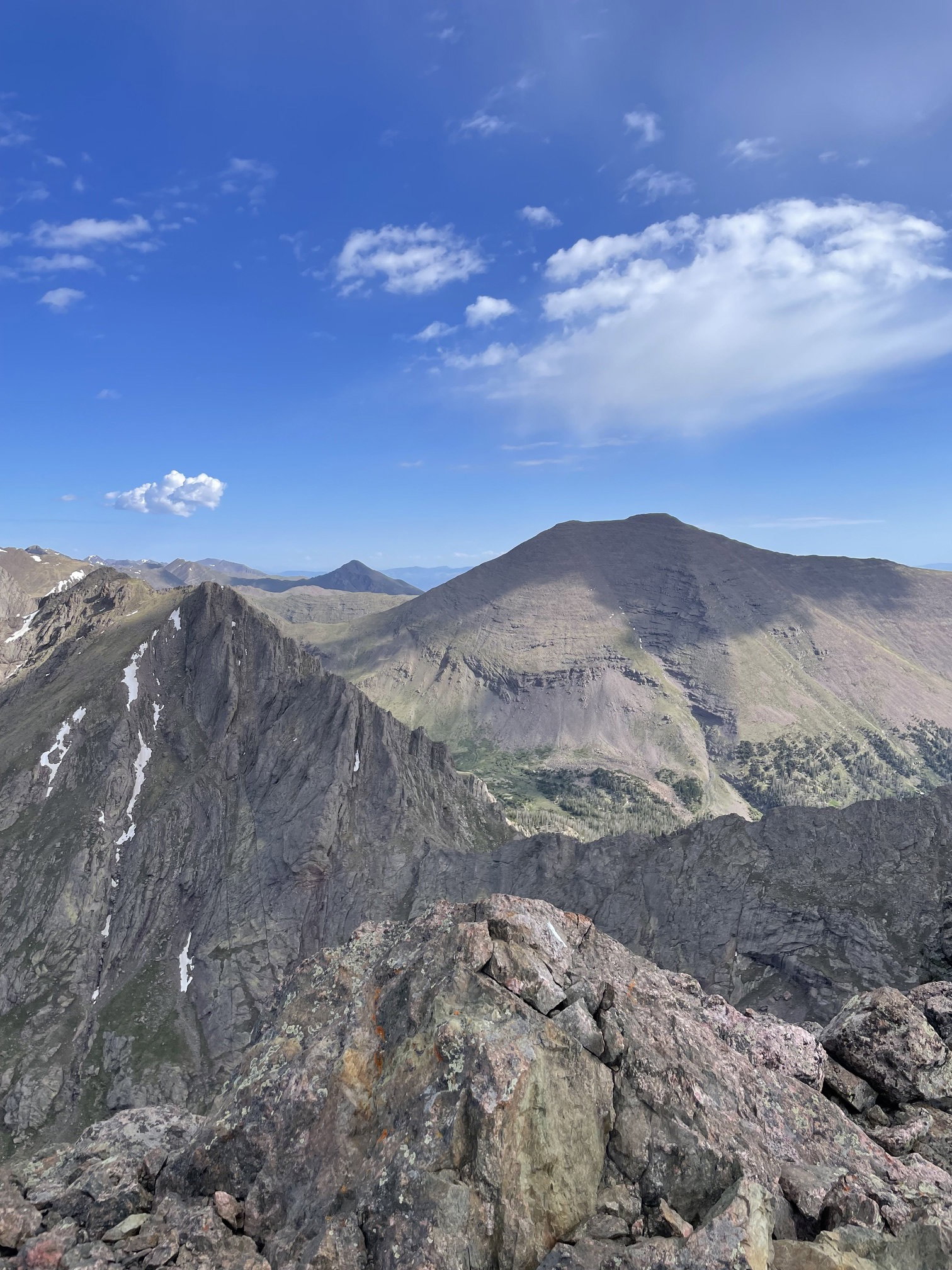
Broken Hand Peak, Colony Baldy (background), and Humboldt Peak from the summit.
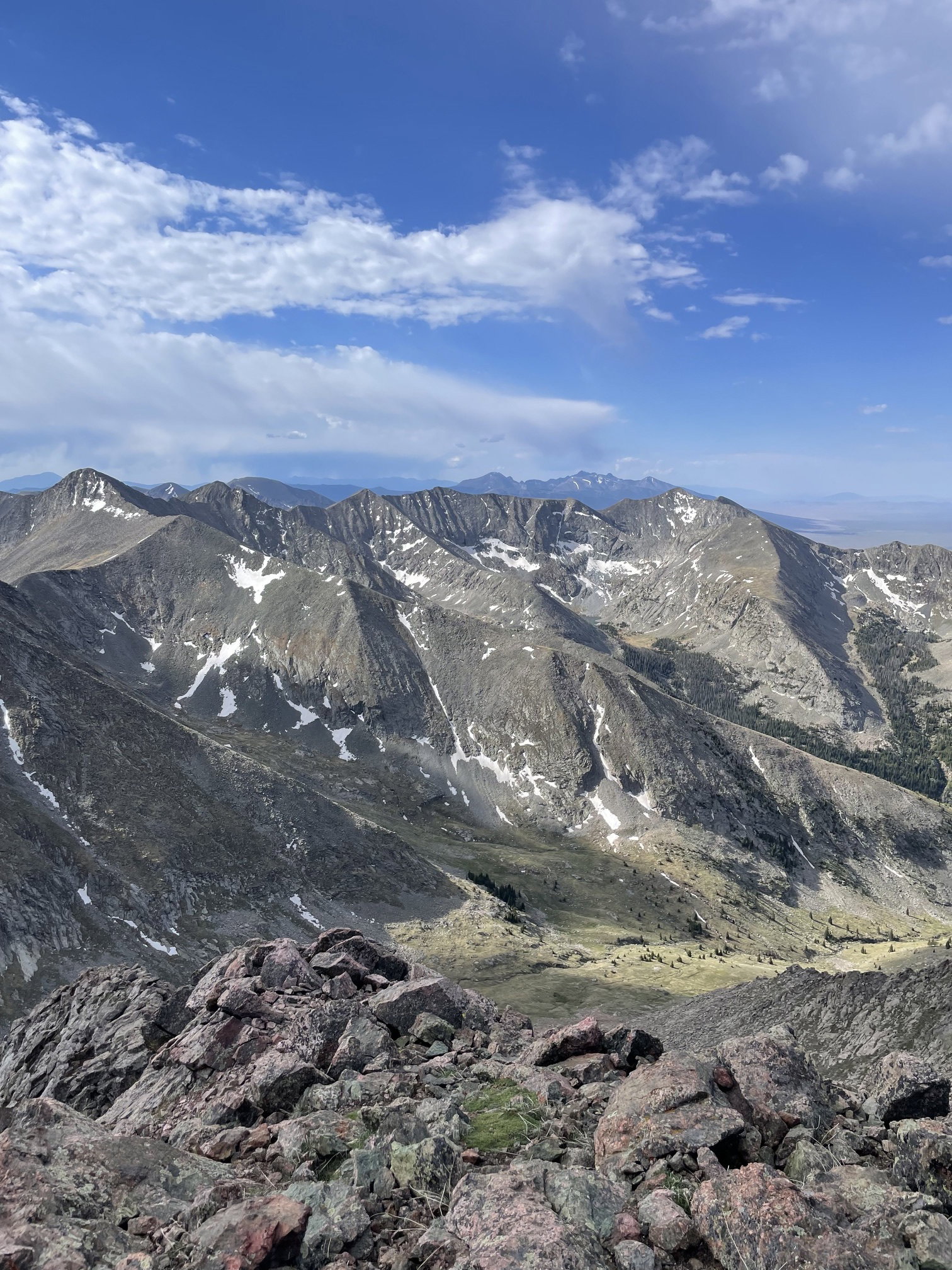
Crestolita, Crestone Peak, Crestone Needle, and Broken Hand Peak from the summit.
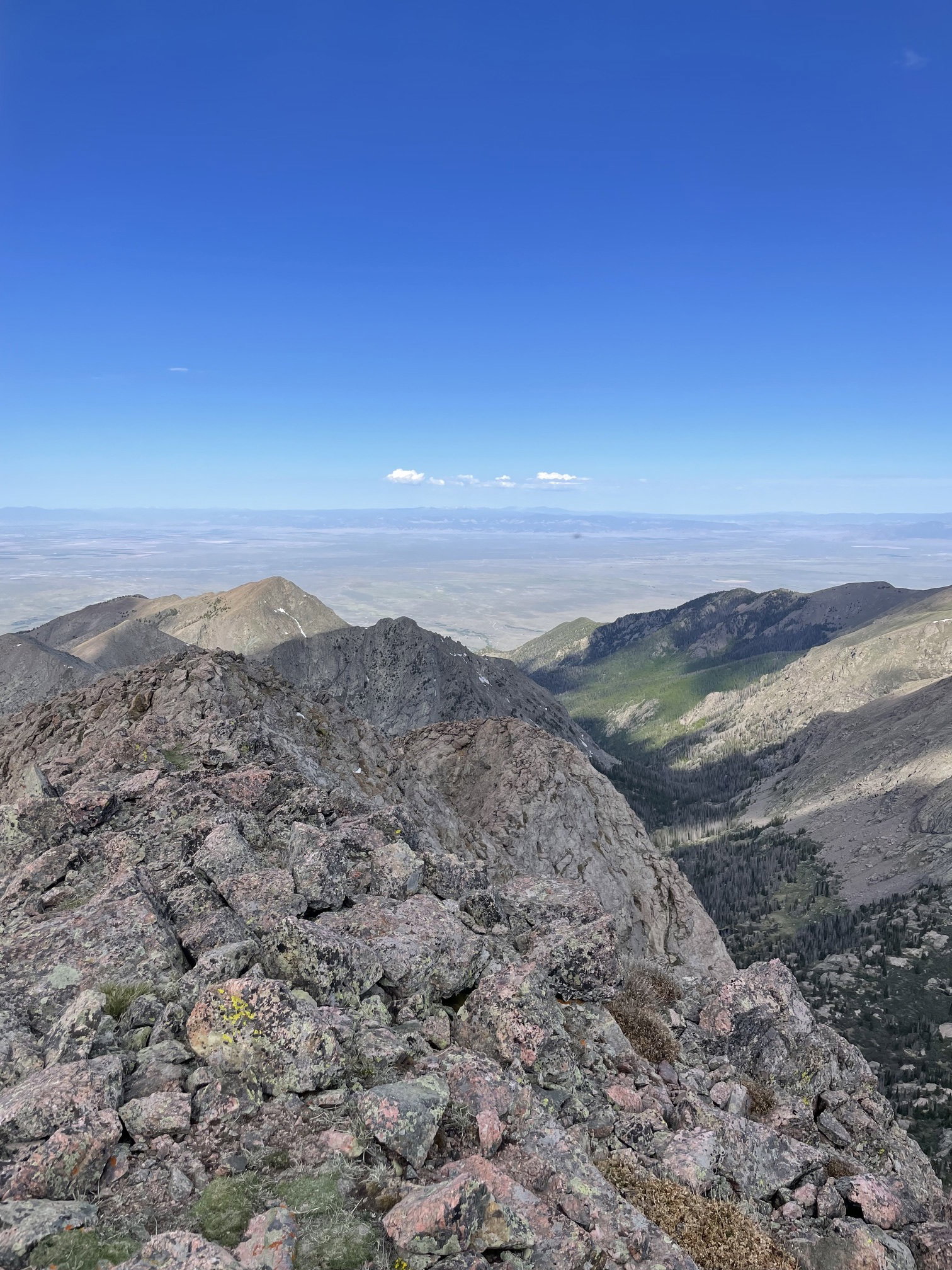
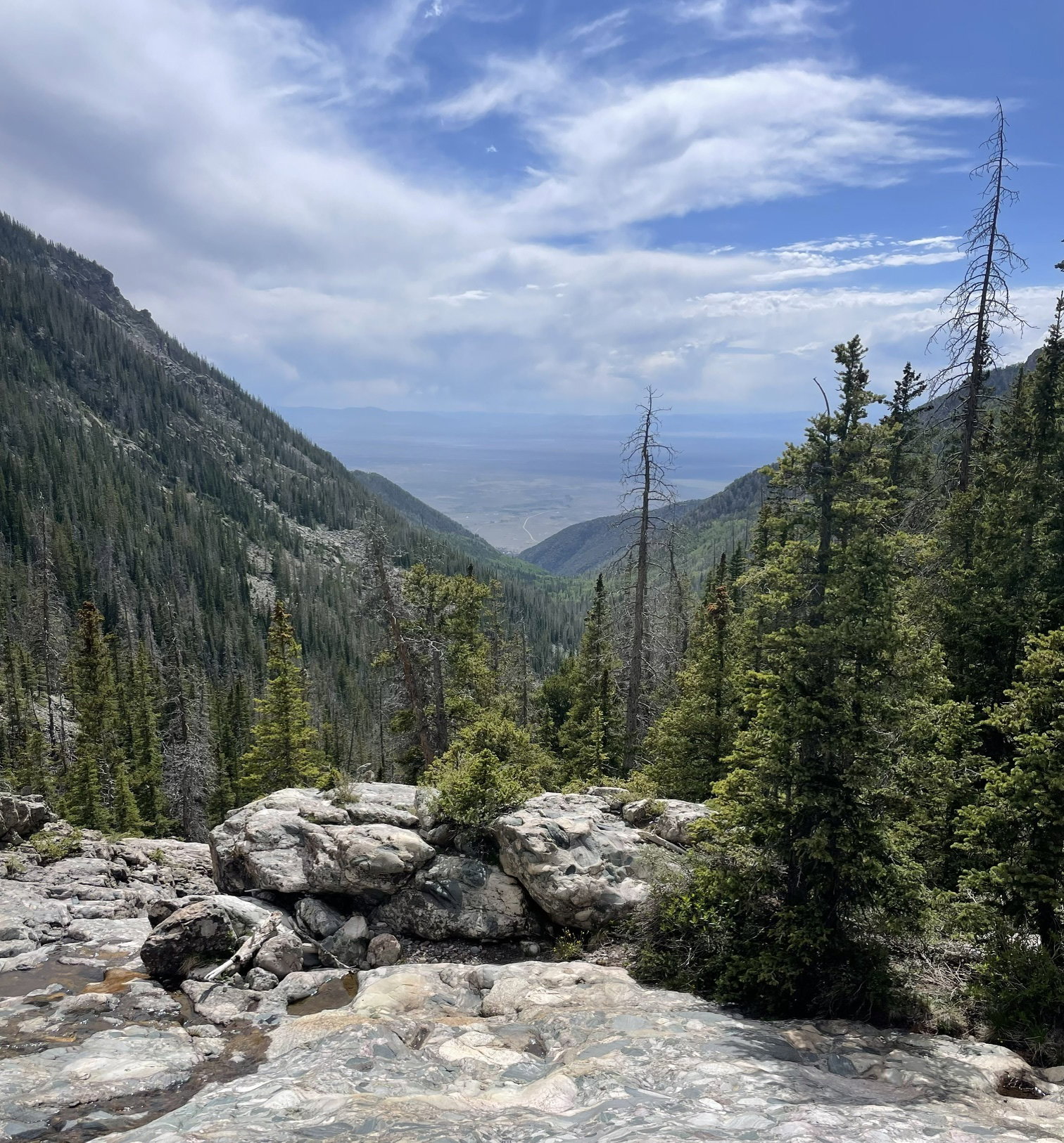
Views to the west down Cottonwood Creek and the San Luis Valley from the summit.
Views to the south from the summit.
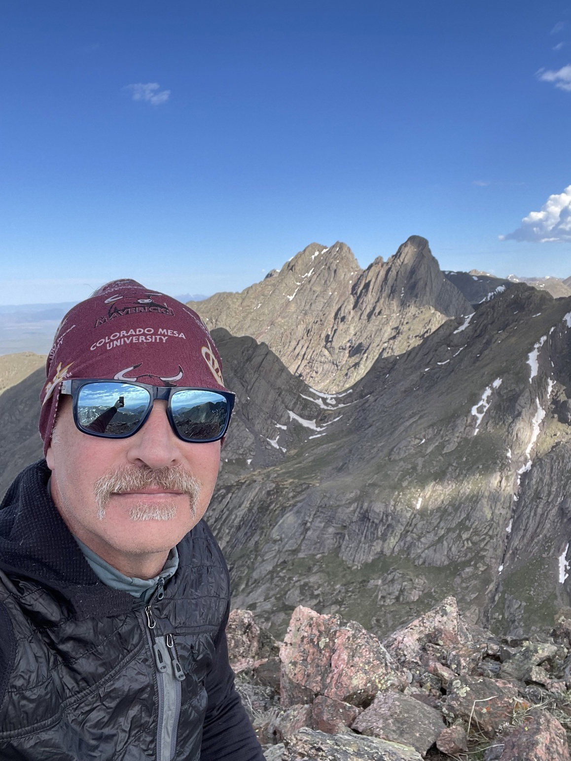
Summit Photo (Pico Aislado)
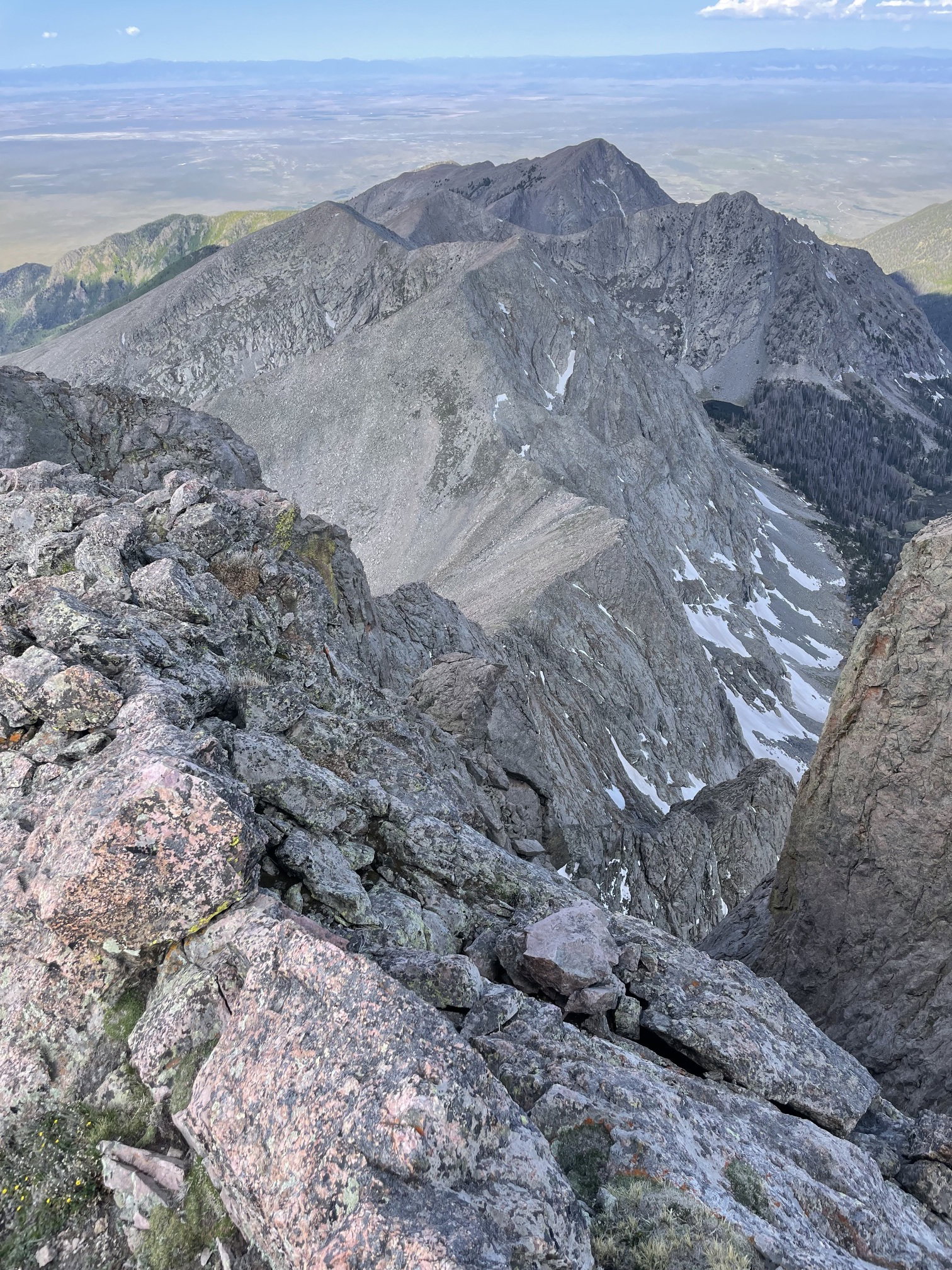
Looking down the west ridge of Pico Aislado with Point 13020 hidden in the background.
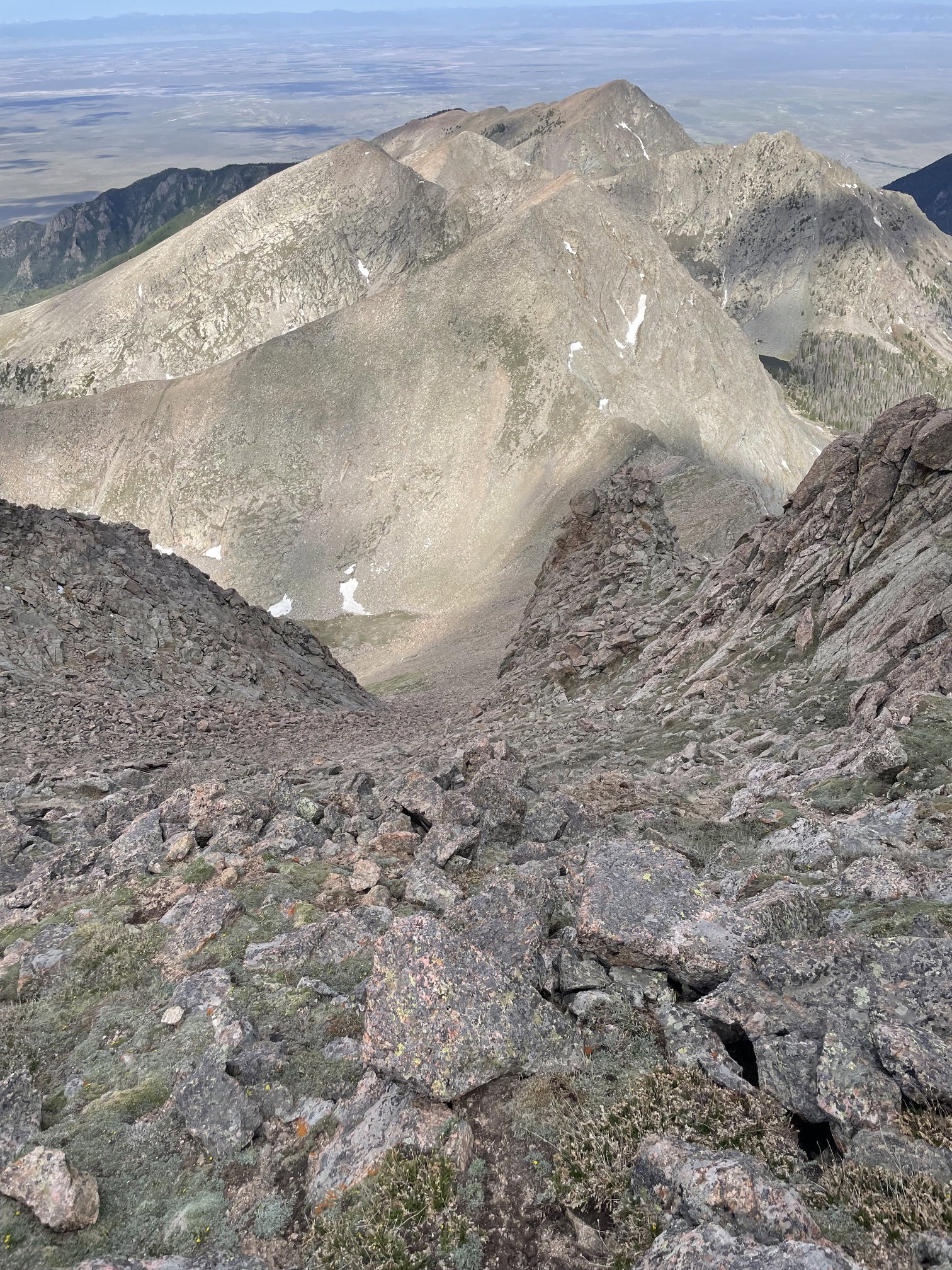
Looking down the Pico's west face gully that I descended.
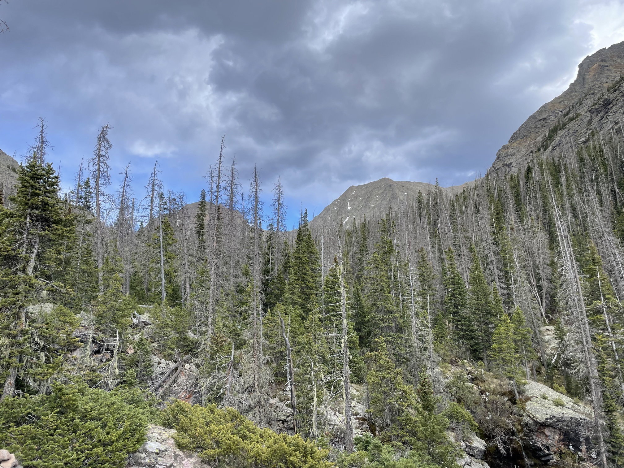
The complex west ridge/face of Pico Aislado on the hike out.
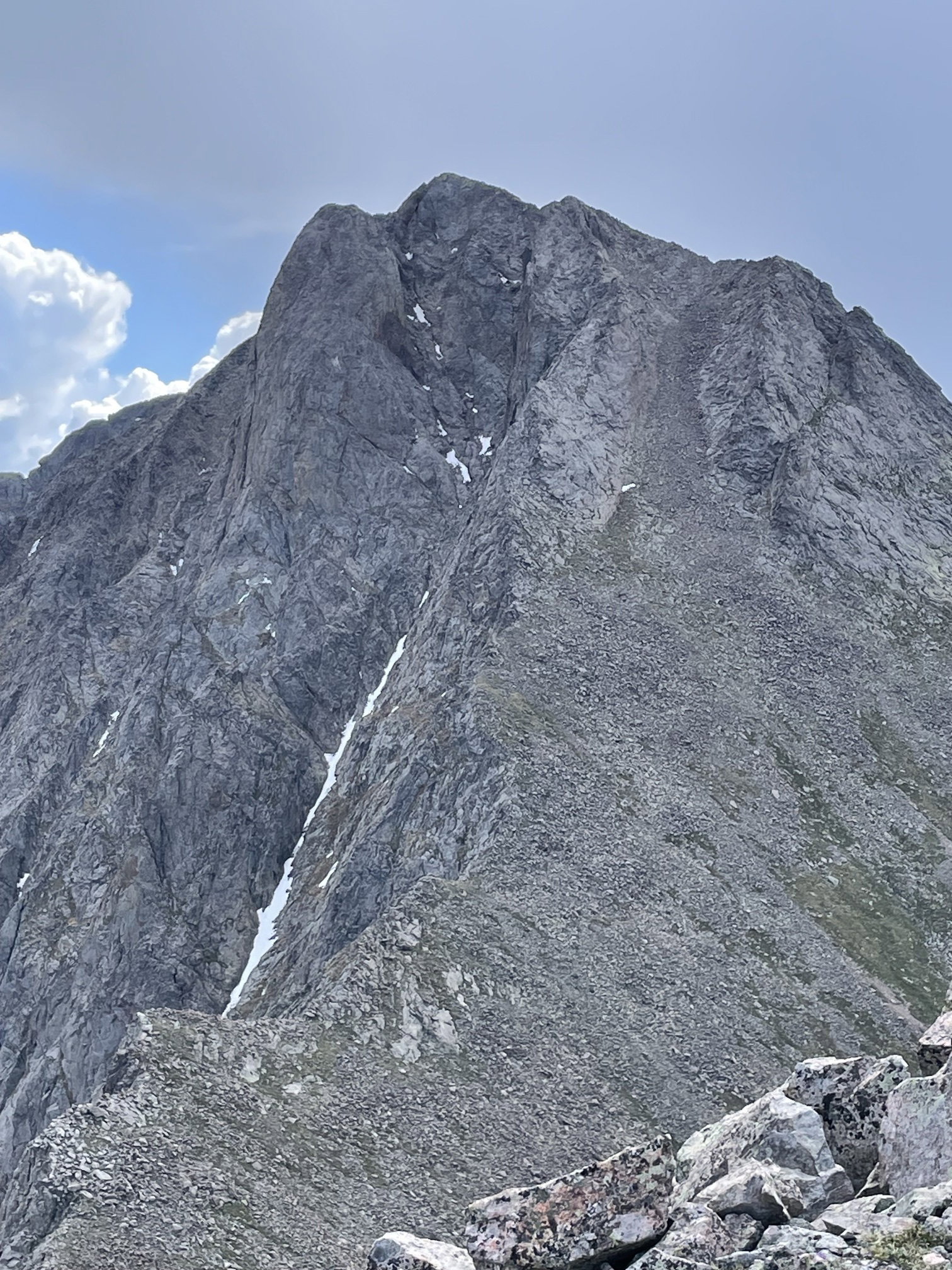
One final look at the complex west ridge/face of Pico Aislado on the hike out.