
Taylor Peak (2)
Statistics
- Date - 05/31/2010
- Elevation - 13,153'
- Route - AYFKM Couloir
- Miles - 11.0
- Elevation Gain - 4,200'
- ACME Mapper - Link
- CalTopo - Link
- Partners - Brian Kooienga
Description
Brian and I intended to climb a cool route in the Loch Vale area, but got side-tracked and ended up climbing an unnamed couloir on Taylor Peak. We were hiking from the Glacier Gorge Trailhead at 4:30 and made relatively descent time to The Loch. I struggled all day with low blood sugar levels and didn't perform too well. In addition, I was at sea level the week before this hike and had a relatively big week of running prior to the climb. Anyway, we topped out on the couloir and Taylor Peak and descended down Andrews Glacier. Instead of heading left above Sky Pond up Taylor Glacier, we turned right for a slightly more direct line to the summit ridge. The first two-thirds of the couloir was moderate at 40 to 45 degrees, and the upper third was a melted out nasty scree scramble with loose rock.
We took the shortcut on the way in and had to deal with a nominal amount of post-holing even at 4:30 in the morning. On the way out, we decided to play it safe and take the standard trail around past Alberta Falls. There were a lot of tourists out hiking this Memorial Day. When we got back to the trail junction with the sign that reads "Alberta Falls-0.6 Miles", there was an older gentleman contemplating whether to continue on. Dressed in full mountaineering gear with helmets, boots, and ice tools visible, he asked us how the falls were and whether it was worth the hike in. Brian looked him and said, "We didn't make it." The hiker looked a little disappointed and remained indecisive.
Photos
 Approach
 Taylor Peak
 Petit Grepon
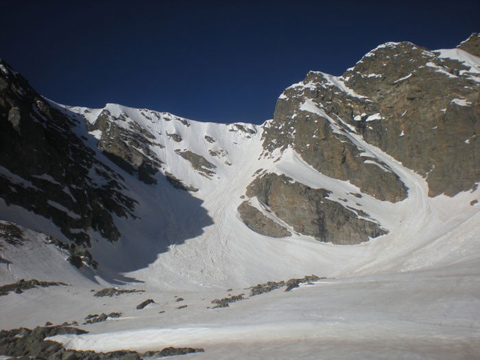 Taylor Glacier
 AYFKM Couloir Apron
 James
James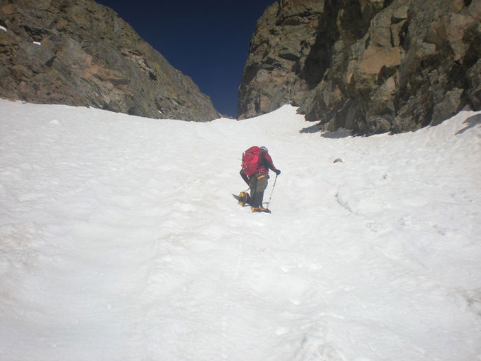 Brian
Brian Top of the couloir.
 Longs Peak
 Brian unhappy with the route.
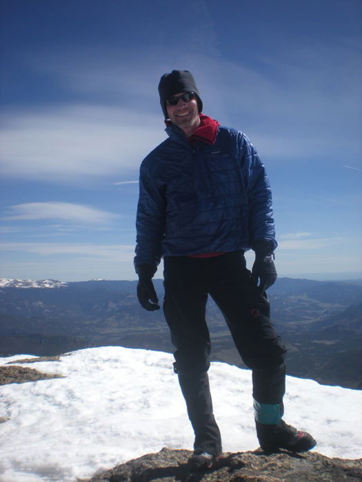 Summit Photo
 Descent
 Andrews Glacier
 Glissade
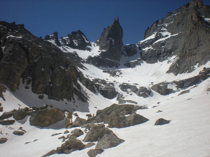 Sharks Tooth
 Glissade Track