
Chimney Rock (2)
Statistics
- Date - 08/08/1998
- Elevation - 7,075'
- Route - West Route
- Miles - 5.0
- Elevation Gain - 1,070'
- ACME Mapper - Link
- CalTopo - Link
- Partners - Lane Berendt, Vicki Jackson, Payton (Dog)
Description
By reading the narrative from Chimney Rock (East Route), you know that my transportation needed an upgrade. Fortunately, I accomplished this by convincing my wife that my Honda CRX was useless with a baby on the way. So, I sold my car and got a 1991 Isuzu Trooper II. I know it isn't a Nissan Xterra or Land Rover, but it gets the job done. The new vehicle came just in time too. I convinced two of my coworkers to go on this hike with me, and I needed the room. The Chimney Rock (West Route) trailhead begins from the Priest Lake side of the range. The road gets extremely rough towards the last mile before the trailhead, so anyone wanting to hike this trail should have a high clearance vehicle. The trail is well maintained and gains elevation gradually until you climb the west ridge of Mount Roothann where Chimney Rock will be in sight. From here, the trail plunges steeply to the bottom of a cirque. One must basically scramble through the talus to reach the base of Chimney Rock. The three of us decided to stay at the saddle and have something to eat before simply returning to the Trooper.
Photos
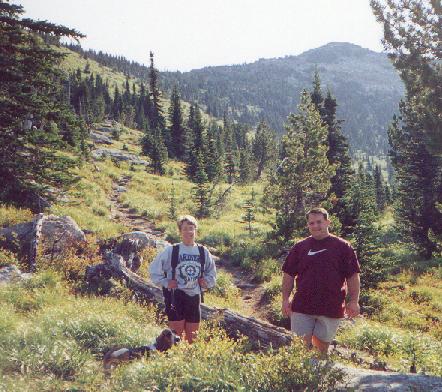 Vicki and Lane
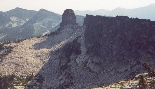 Chimney Rock
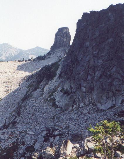 Chimney Rock