
Ulysses S. Grant Peak
Statistics
- Date - 06/07/2024
- Elevation - 13,767'
- Route - West Ridge
- Miles - 7.0
- Elevation Gain - 3,500'
- ACME Mapper - Link
- CalTopo - Link
- Partners - Not Applicable
Description
My work found me in southwest Colorado on a somewhat unexpected trip. Although early June can still be challenging to get into the backcountry, I decided to take advantage of the assignment and attempt a Bi-Centennial Peak in the area. Ulysses S. Grant Peak is the 119th tallest mountain in the state of Colorado according to old map elevations.
I left Durango, Colorado, at 4:15 am and was hiking from the Clear Creek Falls Trailhead at 6:20 am. This cuts off around a mile and 500' of elevation gain. I hadn't been to the mountains for quite some time and hadn't been ice climbing in almost two months. In the interim, I spent a couple weeks in Europe on holiday and a week in North Dakota attending two high school graduations. Nevertheless, I knew the day would be a struggle due to being old, fat, out of shape, and lazy.
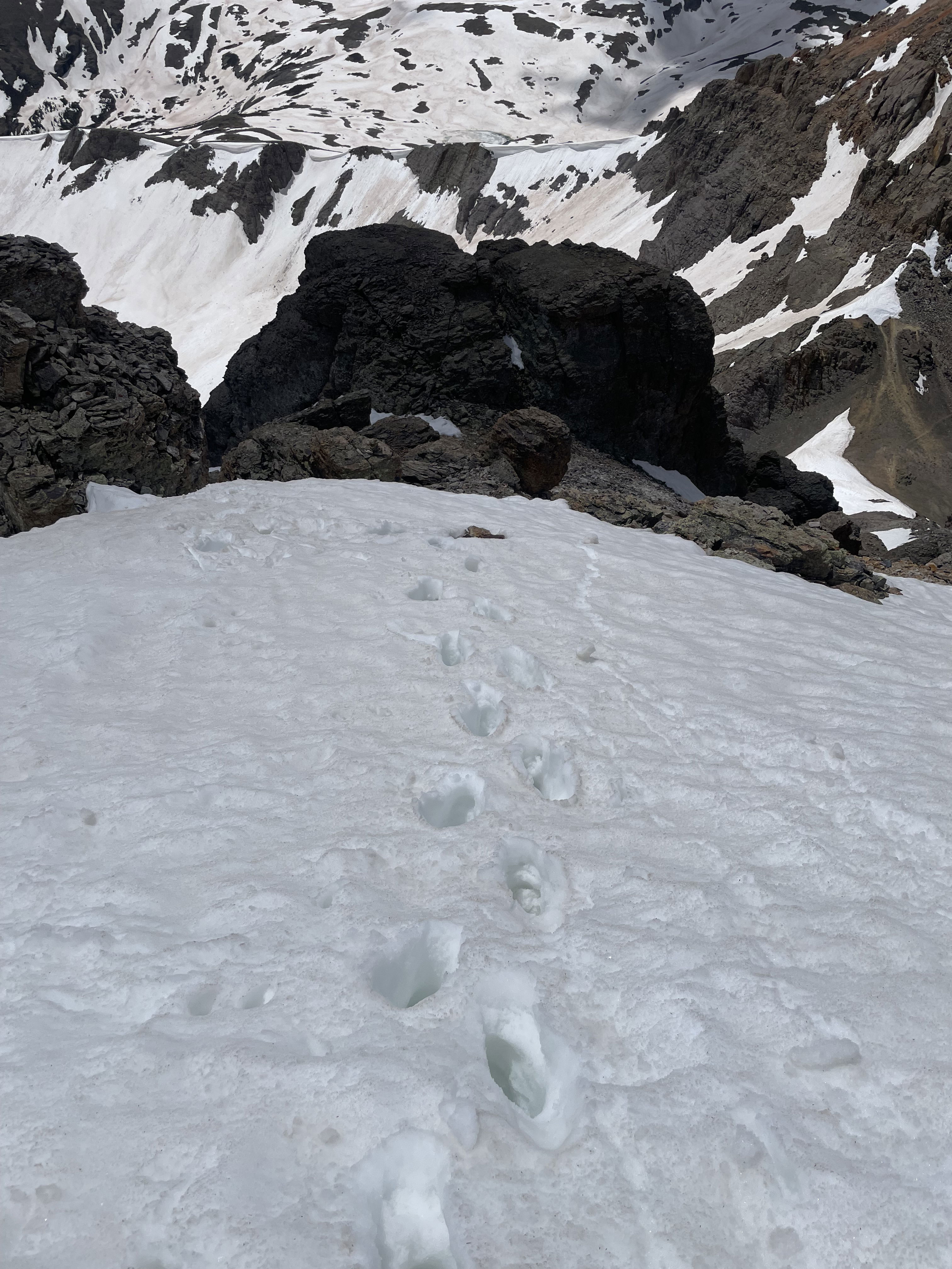
I struggled with low blood sugar most of the day, but surprisingly made it to Island Lake at 8:30 am after gaining 2,000'. Things slowed down considerably for me at this point, but I couldn't complain as the weather, views, and mountains were pretty amazing. From Island Lake, my objective was the saddle between V4 and Ulysses S. Grant Peak. The entire basin was full of snow, so I opted to use crampons for more secure footing; however, an ice axe was not necessary as the angle was mellow.
I reached the saddle at 10:10 am and was able to remove my crampons as the west ridge was mostly melted out. The initial 350' of the ridge from the saddle to the summit of the peak was mostly easy scree slogging until I started to run into patches of snow. I began to have concerns about summiting as these intermittent areas of snow were annoying at the least. I got through a soft section of snow and found myself at the base of the class 4 crux I had read about in several trip reports. This short more technical section wasn't too bad and I soon found myself traversing across a narrow ledge to the final summit gully.
The final gully is actually where the difficulties increased for me although it is considered class 3. The entrance to the gully was filled with ice and snow, but it wasn't continuous to the summit ridge. I opted to climb on the side of the snow and leave my crampons off. I slowly made it up the gully after some tricky and delicate scrambling to avoid the snow. I hiked across the summit ridge to the top of Ulysses S. Grant Peak and enjoyed the views.
I was nervous about downclimbing the gully so I didn't stay long and made my way back to the entrance of the descent. I decided to go down facing in on the rock until I ran into the snow. The gully was't super steep, but it was weird downclimbing with limited foot and hand holds. Also, it seemed pretty "dirty" to me with lots of small rocks on all the ledges that kept things interesting. Once I was at the snow, I couldn't really access the dry rock on the edges of the gully, so I carefully put on my crampons and pulled out my ice axe.
I was able to front point face in down a couple of short sections of ice or simply sink deep into soft snow as I downclimbed. I was pretty relieved to be back on the narrow ledge that leads back to the top of the class 4 section. I rested on the ledge for a bit, removed my crampons, and made quick work of the class 4 downclimb. From this point, I had a few more sections of snow to deal with that weren't terribly troubling and I was back at the saddle between V4 and Ulysses S. Grant Peak in short order.
I caught several long glissades from the saddle back to Island Lake where I removed some clothes and prepared for the hike out. Despite being a very popular hike into Ice Lakes and Island Lake, the trail wasn't very busy since it was only early June. I got back to the Clear Creek Falls Trailhead at 1:20 pm for a seven hour car-to-car day. I moved pretty slowly all day ascending in 4 hours and 40 minutes and returning in 2 hours and 20 minutes. Seven hours to go seven miles isn't very impressive! After returning to the trailhead, I drove into Silverton, Colorado, had a late lunch, and refilled my water supplies.
I drove back up to and past South Mineral Creek to the Rico-Silverton Trailhead. My plan was to hike Rolling Mountain the following day. Unfortunately, less than a mile into my hike I ran into significant post-holing, and the snow-covered trail made navigation and route-finding much more challenging than it should have been. I struggled with a couple of small creek crossings as the runoff is high from all the snow melt. When I got to the main creek that flows between Rolling Mountain the the Twin Sisters I called it a day. There was no obvious or safe way to get across the raging creek in my opinion.
Photos

Clear Creek Falls at the beginning of my hike.
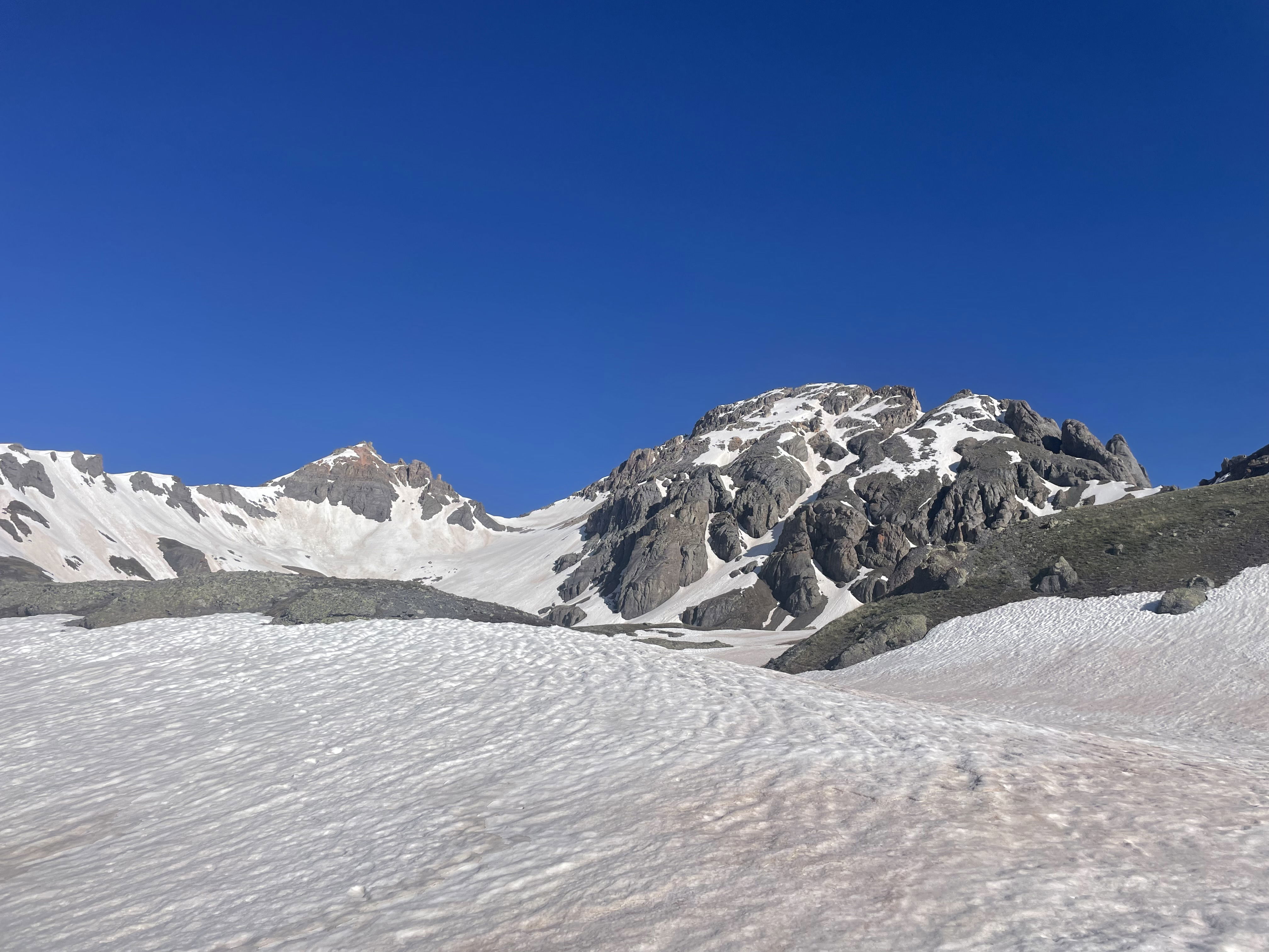
My first views of V4 and Ulysses S. Grant Peak.
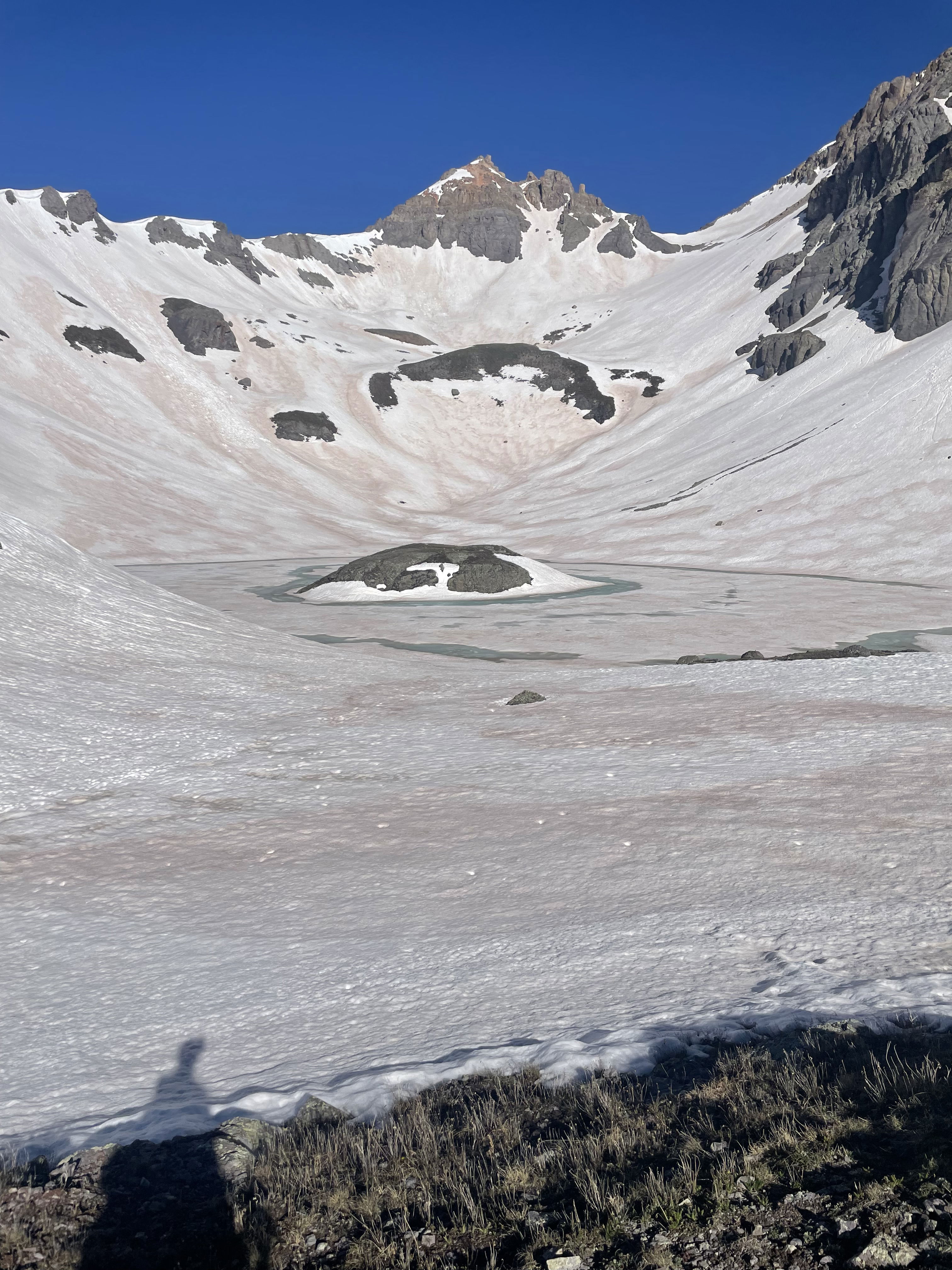
Island Lake with V4 in the background.

V4 and Ulysses S. Grant Peak from near Island Lake.

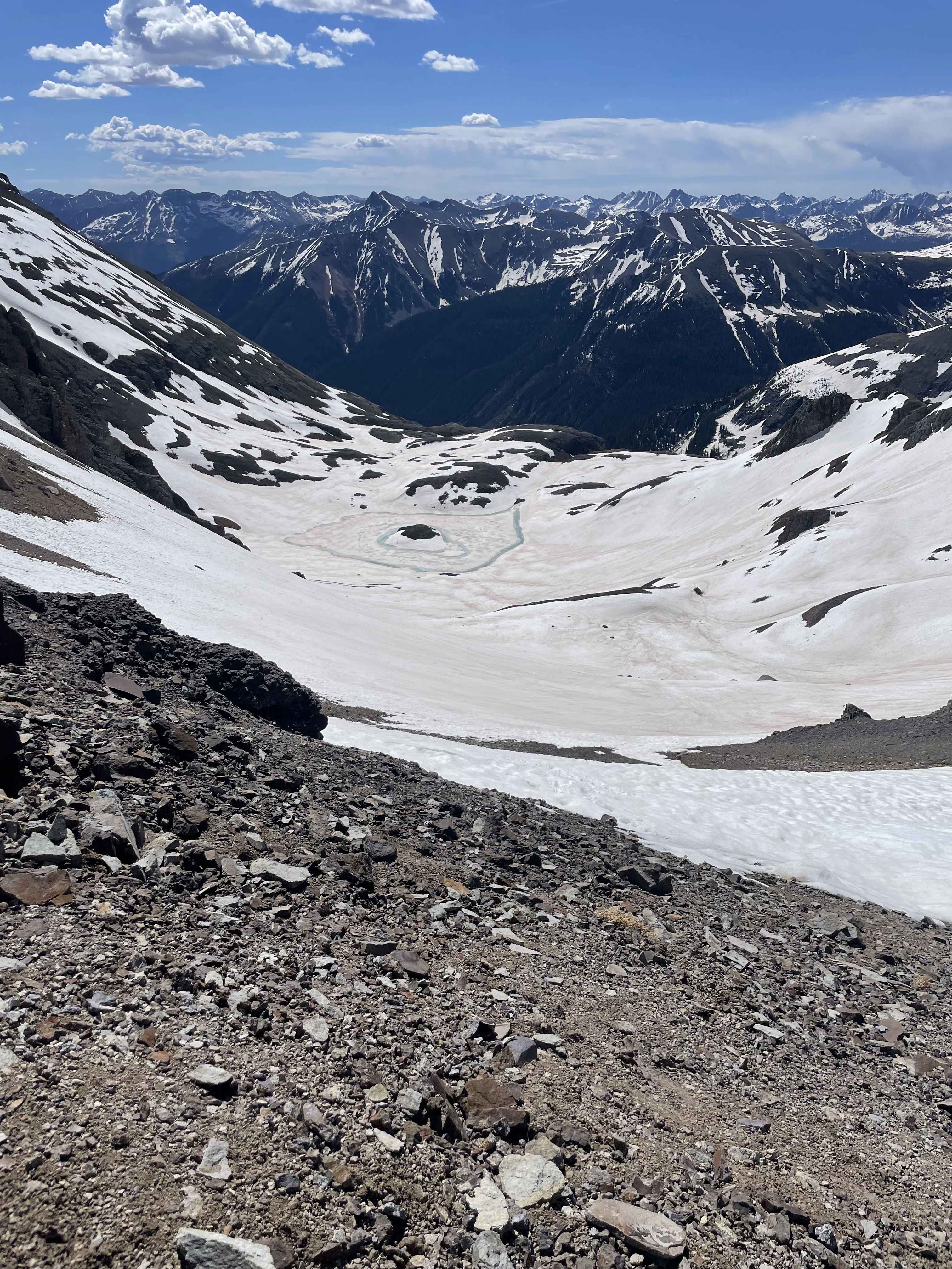
V2 and Island Lake from about half way up to the saddle.

The saddle between V4 and Ulysses S. Grant Peak about half way up the snow.
Island Lake from the saddle.

The start of the west ridge of Ulysses S. Grant Peak from the saddle.
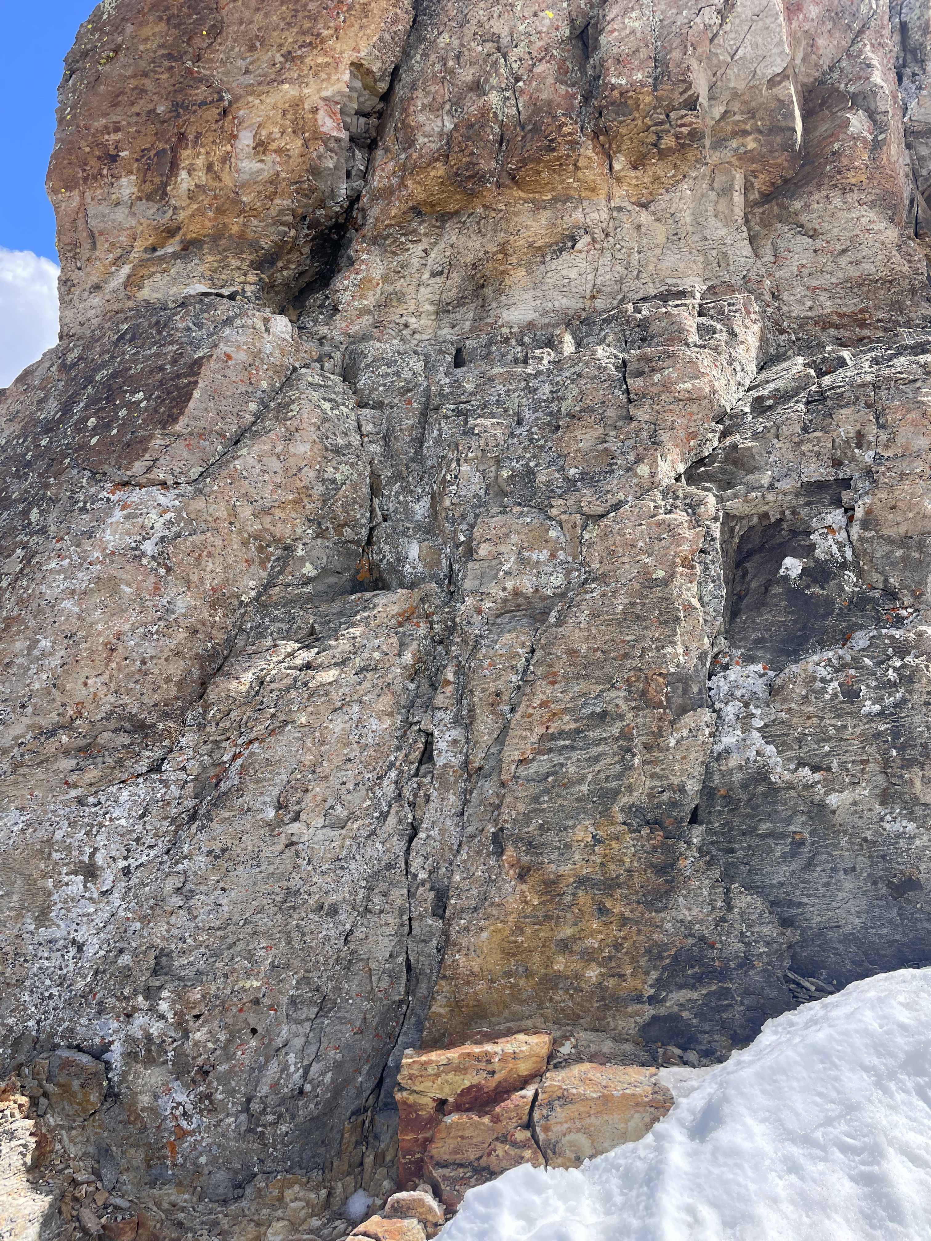
The short class 4 crux section. It starts on the orange flat rock at the base and ends near the black rock up and to the left.
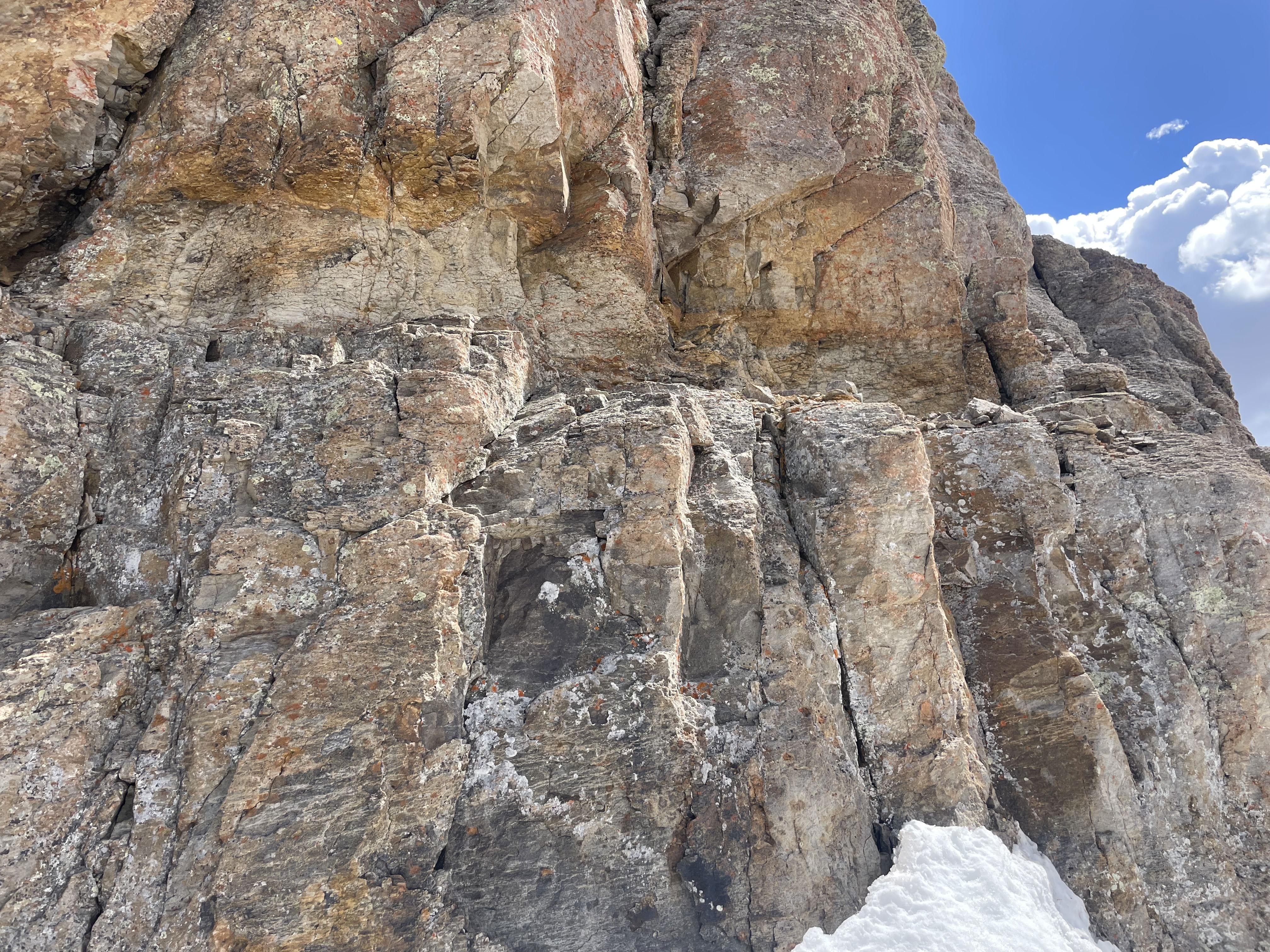
The ledge at the top of the crux you scramble across to get to the final gully.

Summit Photo
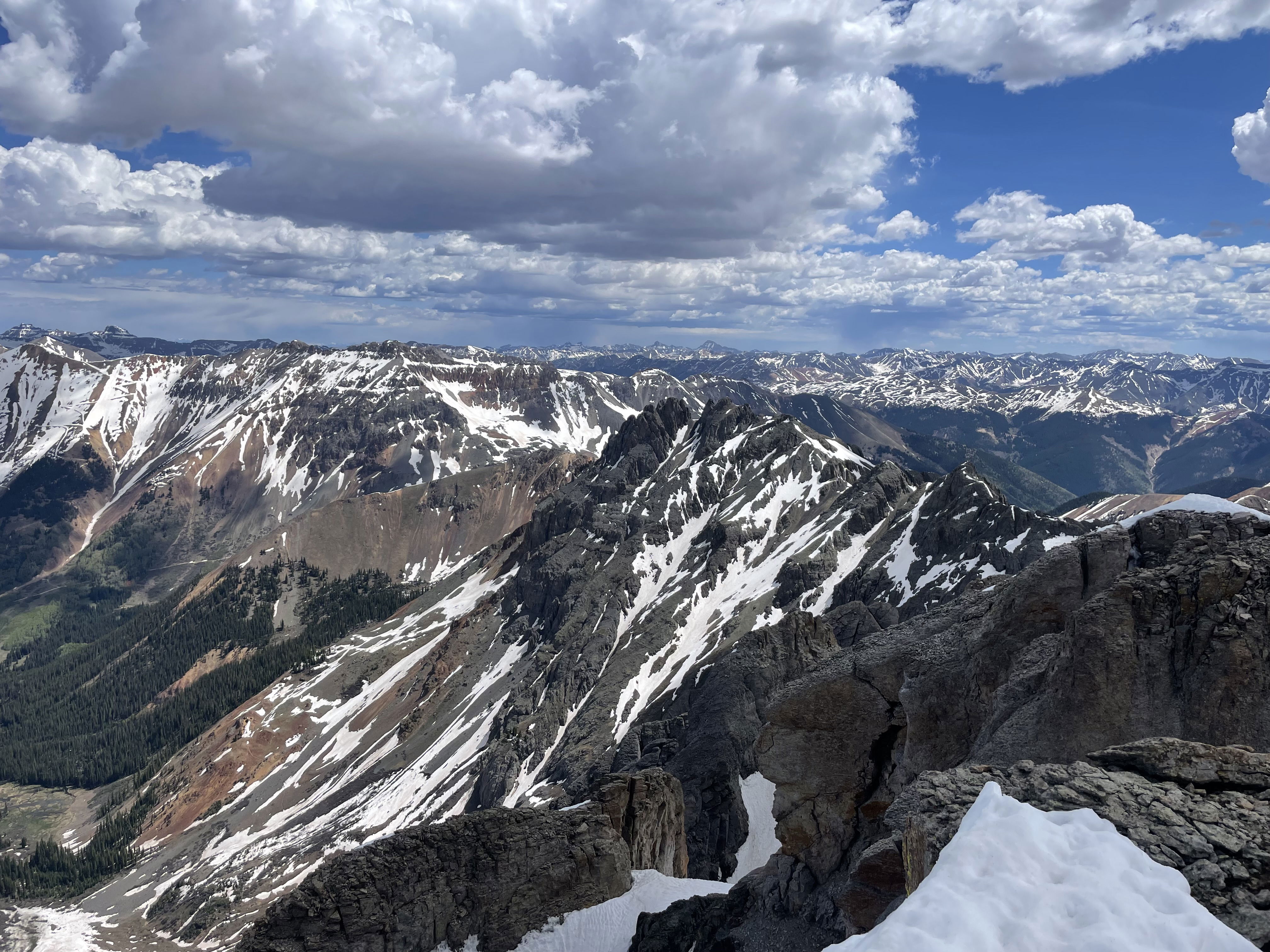
Views to the east.

Views to the north.

Views to the northwest.
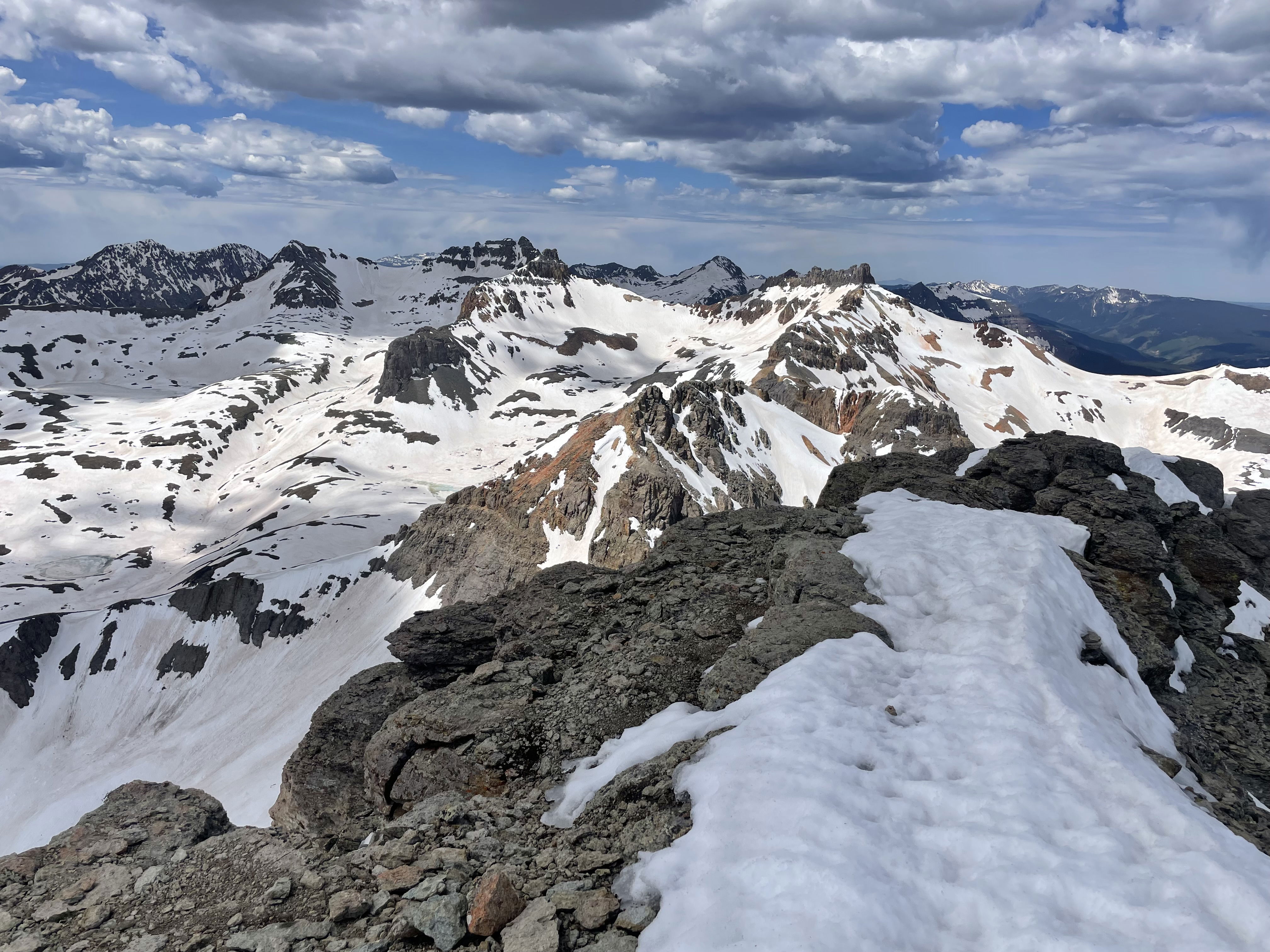
Views to the west.

Views to the south.
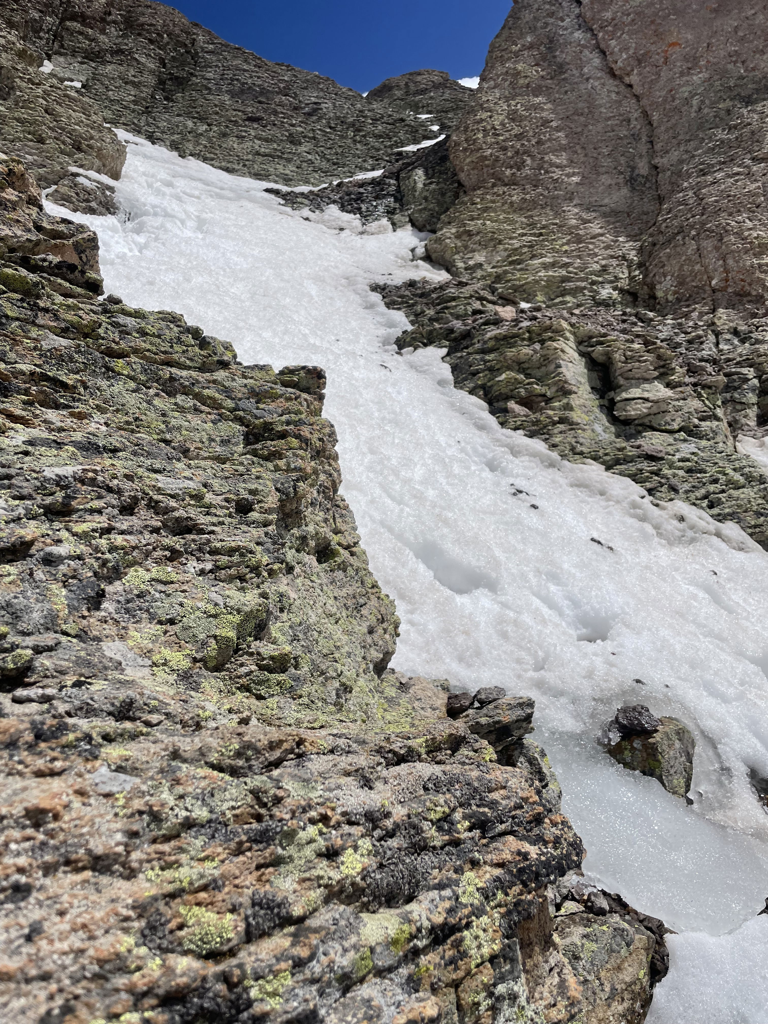
The challenging final ascent gully after I was back down.

The ledge that takes you back to the class 4 crux chimney.
Another section of snow I had to contend with on the climb.

Back down at Island Lake after several glissades.

One final look at the Island Lake and Ulysses S. Grant Peak on the hike out.