
Dishman Hills
Statistics
- Date - 05/21/2000
- Elevation - < 7,000'
- Route - Various Nature Trails
- Miles - 4.0
- Elevation Gain - 0'
- ACME Mapper - Link
- CalTopo - Link
- Partners - Not Applicable
Description
Dishman Hills Natural Area is located in the middle of the Spokane Valley. Although surrounded by the city, it is still a nice area to explore if you are limited by time. This is not a difficult stroll, and the trailhead area reminded me of the park near the Liberty Lake hike. The 450 acres that the Dishman Hills encompasses is criss-crossed with several trails, some of them well traveled and others very faint. I began by heading south from the parking area to the Enchanted Ravine. I took a look at the "skull" and then went northwest towards the East and West Ponds. I overshot the intersection to go to the ponds and ended up at the northern boundary to the Dishman Hills Natural Area.
I returned back south and noted an arrow built of rocks pointing the way to the ponds. The East Pond was bigger than the West Pond, but they were definitely ponds. After this, I continued west past the ponds and then hung a left in search of the Lost Ponds. After hitting a road at the end of one trail and then a terminus at another, I crossed back over the center of the area and found myself at the trail heading northwest towards the ponds. From here, I backtracked the way I had begun my hike and was unsuccessful in finding the Lost Ponds. I guess they are appropriately named. It was an acceptable walk for a Sunday afternoon or with the family, but it didn't really feel like a hike.
Photos
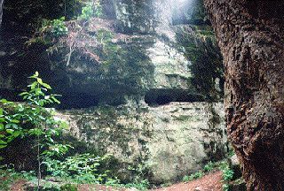 The Skull
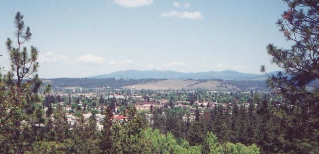 Mount Spokane
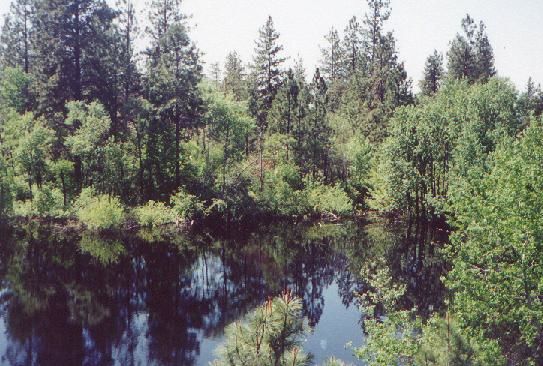 East Pond